A day by day look into my life as I explore all of the beauty that this world has to offer
Wednesday, October 21, 2015
Slideshow Daleville, VA to Harper's Ferry, WV
Daleville, VA to Harper's Ferry, WV. Highlights include The Blue Ridge Parkway, The James River Foot Bridge, Shenandoah National Park, and The Bears Den Hostel.
Thursday, October 15, 2015
Damascus to Daleville Slideshow
A really fun section that included The Grayson Highlands, Dismal Falls, Dragon's Tooth, McAfee Knob, and Tinker Cliffs. McAfee Knob and Tinker Cliffs comprise one of my favorite days on the trail. Dragon's Tooth offered incredible views, but the descent into camp was very difficult at the end of a long day. Dismal Falls and Trent's Grocery offered a nice distraction from the monotony of hiking. All you need to know about The Grayson Highlands is that there are ponies wondering around!
Wednesday, October 14, 2015
Tuesday, October 13, 2015
Slideshow Springer Mountain to Standing Bear Hostel
Over the next several days I plan on uploading nine slideshows covering my entire thru-hike. I had added some really great music to go along with the pictures, but I just found out that YouTube will not allow copyrighted music. I hope you enjoy the pictures. I took over 6,000 and a only a small portion made it into my daily blog posts.
Day 165- Follow The Golden Road
Sept 13, 2015
Hurd Brook Lean-to(2170.6) to Abol Bridge(2174.1) 3.5 Miles
Today felt like the last few days of high school. I've put in all of the hard work and now it's time to enjoy myself. I only have 15.1 miles until the end. 9.9 of those miles will be nice and easy. The last 5.2 miles, also known as Mt. Katahdin, aren't exactly easy, but I figure the excitement of finishing will out weigh the difficulty.
I woke up to the sound of rain against my tarp. After my ultra marathon day yesterday I had planned to sleep in, but I was too excited to stay in my hammock. We only have to hike 3.5 miles before we get to Abol Bridge on Golden Road, which marks the end of the Hundred-Mile Wilderness and the entrance to Baxter State Park. There isn't much at Abol Bridge except for a campground with cabins and a camp store, but we are staying there due to the logistics of finishing the hike. Once you enter Baxter State Park(BSP) there is a one night limit for thru-hikers to camp. Due to rain in the forcast for the next two nights we won't be summiting Katahdin until September 15, so we can't camp inside the park tonight. Since the camp store offers breakfast, Blade, Laces, and I decided to walk through the rain. For some reason hiking in the rain doesn't seem that bad when there is fresh coffee and breakfast at the end.
Laces was packed up and ready to go before Blade and I so we told her we would meet her at the store. It takes me longer to pack up my things in the rain. Blade and I enjoyed a nice and easy hike down to the road. The weather improved almost immediately and we were able to finish the 100-mile wilderness on a good note by staying relatively dry.
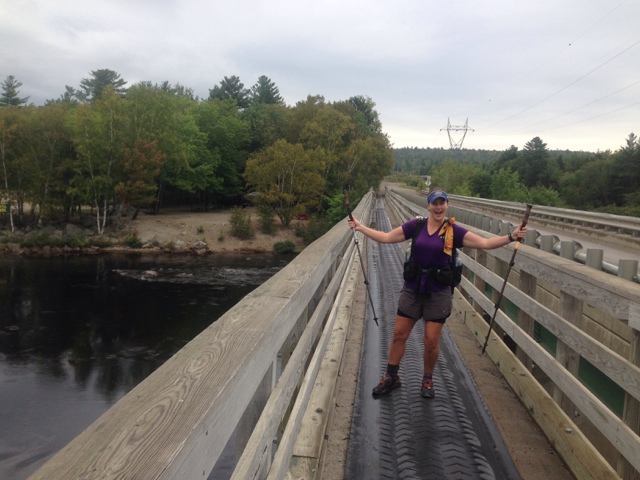
To say that I was excited to finally reach Golden Road would be an understatement. In all of my pre-hike research Golden Road and Abol Bridge marked the beginning of the end for this epic adventure. Walking across Abol Bridge felt like a huge accomplishment. Nothing can stop me now. As I walked across the bridge I could see Mt. Katahdin up close and I was grinning from ear to ear. Knowing that in two days I will be standing on Baxter Peak as a thru-hiker gave me a rush of adrenaline.
We hurried along to the camp store to meet Laces for breakfast, unfortunately the restaurant wasn't open yet so we settled for fresh coffee and cinnamon rolls(we might have also had a breakfast beer or two). Laces mother was meeting her at the campground later in the morning, but she had a few errands to take care of in town before she arrived. We met a few tourists who kindly offered to drive her into the closest town, Millinocket. Blade and I agreed to hang around the camp store to wait for her mom, while she went into town. While we were waiting Clicks dad arrived. He offered to take us to town so we could get breakfast and make phone calls since there was no cell reception at Abol Bridge. It was an offer we couldn't refuse. We left a note for Laces mom and headed out.
Millinocket is a cool little town. Most of the towns income seems to be reliant on BSP tourism. They really catered to thru-hikers. The local diner, AT Trail Cafe, is where a lot of hikers meet up before or after summiting Katahdin. Blade and I enjoyed a nice meal together and talked about life post trail. You would think that after 5.5 months on the trail I would have a plan for life after, but as it turns out I mostly day dreamed about pizza, hamburgers, and milkshakes.
I haven't had cell phone service in days, so I took the opportunity to update my blog and call home. Millinocket is located 19 miles from Abol Bridge and I really didn't have a plan for getting back there. Blade was staying in town with Click and his dad, 5-Way(several years ago he had a 5-way heart bypass). I didn't want to stay in town yet, it felt too much like a celebration, and I didn't feel like celebrating in town until I had stood atop Mt. Katahdin. Luckily, 5-Way reappeared and offered to take me back to Abol Bridge.
Once back at the camp store I reconnected with Laces. Her mom had already been there, but had to make the 3 hour drive back home to pick up an important package for 8 Paws. We spent the afternoon hanging out at the store and collecting hiker trash as they came through. We rejoined with Lean-to, 8 Paws, Pony Puncher, Food Truck, Zen, Huckleberry, Rusty, and Flick. It was a full blown party. We signed up for two cabins, which had a great view of Katahdin, and bought some beer. Eventually the restaurant at the camp store opened so we all went for in for a snack. I tried Poutine, a northern dish consisting of French fries smothered in gravy and cheese curds, for the first time. It was delicious and I demand that restaurants in the south start serving it.
After our late afternoon snack we were pleasantly surprised to meet Flick's mom and dad who had flown in from Florida. They brought along trail magic and we had a great time hanging around a camp fire cooking hot dogs and hamburgers. Rusty and I went back to Abol Bridge to watch the sunset over Katahdin.
We stayed up really late drinking beer and reminiscing about trail life. I'm really thankful to be surrounded by so many great trail friends here at the end.
"You have no control over how your story begins or ends. But by now, you should know that all things have an ending. Every spark returns to darkness. Every sound returns to silence. Every flower returns to sleep with the earth. The journey of the sun and moon is predictable. But yours, is your ultimate art." -Suzy Kassem
Wednesday, September 16, 2015
Success!!!!
I'm officially an Appalachian Trail Thru-hiker. On Sept 15, 2015 at 10:15 am, I summited Mt. Katahdin. I apologize for the delay in posting my blog, but as you can imagine it had been an emotional three days. I will have the blog updated as soon as possible. I would like to take this opportunity to thank all of my readers for following me along this incredible journey. I could not have done it without the support of each and everyone of you! Never in my wildest dreams did I expect so many people to follow along. THANK YOU!
I will be flying to Florida early tomorrow morning to join my family at the beach. In the meantime I would like to share a few of my summit day pictures with you. Thanks again, and I will catch up on the last few days soon. Also, I have decided to continue the blog with statics from the trail, gear reviews, and slide shows from all of my 5,000 pictures.
Day 164- An Epic Day
Sept 12, 2015
Potaywadjo Spring Lean-to(2140.9) to Hurd Brook Lean-to(2170.9) 30 Miles
Laces, Click, and I woke up early this morning and we were ready to rock and roll. We had a very ambitious plan layed out. We wanted to finish the 100-mile wilderness and hike all the way to Abol Bridge, 32.6 miles away. The terrain was supposed to be pretty creamy(hiker slang for easy), so we gave it a go. Laces kept telling people we were "trying" to hike 32.6 miles, I kept telling her, "Do or do not, there is no try".
We left camp a little later than I would have liked, 7:00. I wanted to get going by 6:00, but with the shorter days that wasn't possible. We knew that there was a very high probability that we would have to hike in the dark, but we didn't really care. I haven't night hiked yet and I really wanted to give it a go. If we could pull this off, I would have hiked my longest day yet and finally gotten a chance to night hike. I've been focused on hiking 31.1 miles for a while. 31.1 miles is an ultra marathon, or 50K. I've hiked a 5K, 10K, 15K, half marathon, and a marathon. What better way to end my last full day of hiking than by completing an ultra.
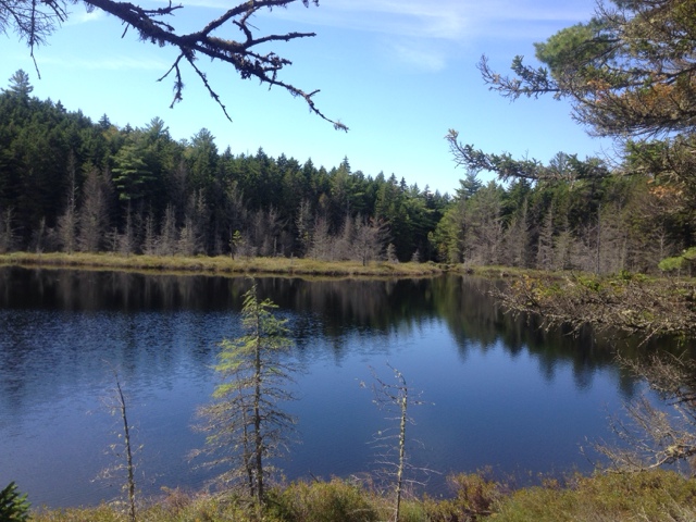
The day started out as advertised, very creamy. Shortly after leaving camp we passed by, Pemadumcook Lake. From the shore of the lake we had a great view of Katahdin.
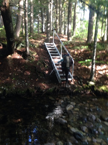
Seeing Katahdin really spurred us on. We cranked out the next few miles pretty easily. We expected to have to ford Tumbledown Dick Stream, but it was just a rock hop. We have been really lucky lately with the stream fords. Even with the rain the last few days we have been able to rock hop across instead of losing time fording. Fording takes forever. You have to take off your socks and shoes, put your sandals on, cross the water, dry your feet off, and then out your socks and shoes back on. The novelty of river fords has quickly gone away. The far bank of Tumbledown Dick stream was very steep and eroded, so the MATC installed a ladder to help us make it up.
Laces and I continued our brisk pace for a few more miles, we were making great time. We were definitely on schedule to meet our goal until the unexpected happened. We hit trail magic!!! It was very unexpected because we were still in the 100- mile wilderness. There are roads in the wilderness, but most of them are gravel or forest service roads. Scrambles, a former AT thru-hiker had a very nice setup. He was right next to Nahmakanta Lake, where he was serving up Starbucks coffee, scrambled eggs, fruit, and an assortment of snacks. We caught up with Lean to, who I hadn't seen since the beginning of the Whites. Scrambles had been there since the day before and had already fed over fifty hungry hikers. Laces, Click, and I seem to be in between two big bubbles right now, which is pretty nice. For the last few days there have been too many hikers around. I haven't been around so many other thru-hikers since Georgia. It makes it difficult to camp at night when we are all fighting for camping spots.
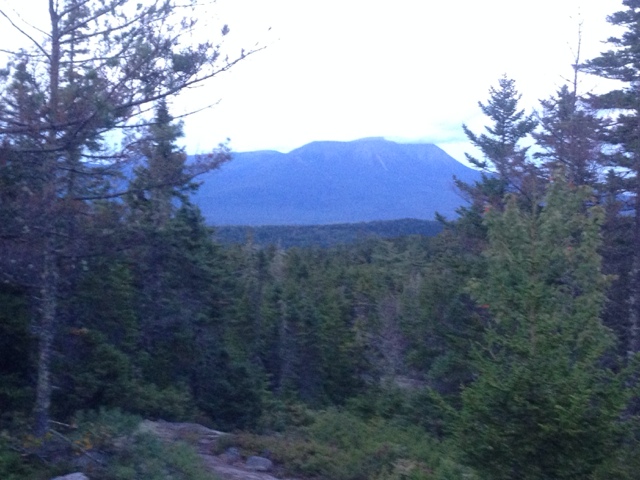
We lost a little of our momentum by stopping at the trail magic, but there was no way we weren't going to stop. Laces and I chugged down a fair amount of coffee and we were all jacked up, which was a good thing because the trail quickly turned from creamy into chunky. Saying that I'm completely over mud, rocks, and roots would be an understatement. I've learned to deal with the rocks and roots, but I'll never get used to the mud. It gets old really quick dealing with wet feet all day. Unlike yesterday, we had a few mountains to climb today. Nesuntabunt Mountain wasn't very tall, but it was pretty steep. Laces and I decided that we needed music to help us up the climb. Luckily it was a short climb, only 800' over .9 miles. From the top we had a great view of Katahdin. From our vantage point it was only 16 miles ahead. This was our first sight of her up close and personal. It was a little intimidating. Katahdin looked really steep, but also very majestic.
Although we were only sixteen miles from Katahdin at this point, it would take us another 28 trail miles before we would reach the summit. The trail bobbed and weaved around the 100-Mile wilderness for the rest of the day. We had several PUDs throughout the day, which was very frustrating. We were so close, but yet so far away. With the end in sight though, our spirits were renewed. We were more than halfway through our epic day and our legs still felt pretty fresh. The only problem was the rapidly decreasing daylight.
We cruised along for several more miles before reaching, Pollywog Stream. As luck would have it, instead of rock hopping or fording the stream, we were able to cross on a logging road with a proper bridge. We were both stoked to have a bridge to walk across.
At this point in our journey any little thing to make our lives easier is very much appreciated. A short time later we walked by, Murphy Pond. We would have liked to stop and go for a swim, but with 12.3 miles remaining that was not possible.
For the remainder of the day we kept coming across nice ponds or lakes that cried out for us to stop at. Unfortunately, that just wasn't in the cards. The most tempting spot was, Rainbow Lake. When we hit that point we were exhausted and we ran into several of out friends camping there. 8 Paws, Pony Puncher, and Food Truck greeted us as we walked by. They tried to convince us to stay and we were so tired that we almost agreed. Instead we settled for an extended break so we could catch up with one another. Blade and Clarity were there as well, which was very unexpected. They should have been twenty miles behind us, but due to a complicated yellow blaze, that I'm not sure I really understand, they had gotten ahead of us. We chatted for way too long, made plans to summit with one another, and convinced Blade to hike out with us. At this point, Laces and I, were moving pretty slow and our dreams of a 32.6 mile day were quickly evaporating. Time was not on our side, we had 2.5 hrs to hike almost eight miles. The thought of night hiking no longer excited us. We covered another two miles relatively quickly before deciding to cut our day short. The new plan was to hike up, Rainbow Ledges, which was a 600' climb and to end our day at the Hurd Brook Lean-to. We would still have to night hike 2.5 miles and we would still hit 30 miles for the day. We wouldn't hit our goal, but we would both have hiked our longest day yet. I was perfectly ok with that.
As we climbed up, Rainbow Ledges, Blade discovered that his headlamp wasn't working very well. Laces and I paused to take in one last look at Katahdin, while Blade hurried on. It was starting to get dark and he needed to cover more ground before that happened.
As we hiked down, Rainbow Ledges, it got dark really quickly. I rapidly discovered that I do not care for night hiking. The rocks, roots, and mud puddles were unavoidable and I was paranoid about hurting myself this close to the end. Our pace seemed to slow to a crawl, but we actually made pretty decent time considering. We made it to the lean-to at 8:30. Setting up in the dark was a new challenge, but I made due. The three of us camped next to each other. While I was setting up, they cooked dinner and ate. When I finished setting up, I skipped cooking and made due with the rest of the snacks in my food bag. Although I didn't hike a 50k, I was pleased to hike 30 miles. I had set that goal for myself before the hike started and it was fitting to have reached that goal on my last full day of hiking.
Tomorrow will be a nero into, Abol Bridge, also known as the first sign of civilization after finishing the 100-mile wilderness. It also marks the entrance into Baxter State Park and the gateway to Katahdin. As this trip comes to an end I am extremely grateful for the time I have gotten to spend with my friends lately. Although I started this hike alone, I have never truely been alone.
"I try to live my life where I end up at a point where I have no regrets. So I try to choose the road that I have the most passion on because then you can never really blame yourself for making the wrong choices. You can always say you're following your passion."
-Darren Aronofsky
Saturday, September 12, 2015
Day 163- The Pine Forest Highway
Sept 11, 2015
Logan Brook Lean-to(2117.8) to Potaywadjo Spring Lean-to(2140.9) 23.1 Miles
I can remember the last time that I did a 20+ mile day. It felt good!!! Laces and I had devised a very aggressive plan for the next few days. The only thing that could possibly hold us back is the weather. It rained all night last night and it was still raining when I woke up this morning. I wanted nothing more than to stay in my warm sleeping bag, but miles don't just happen. I reluctantly pulled myself out at 6:00. The forcast called for rain until 12:00, with a high of 60 degrees. It was going to be a long day. I hate hiking in the rain and I especially hate hiking in a cold rain. It is fitting that the trip would end like this, since that is exactly how it started on Soringer Mountain, cold and wet.
The first eight miles of the day were more of the same. We climbed up a few mountains. Slid over rocks and roots and walked through big puddles of mud. The only difference from yesterday is that it was raining today. We were all pretty miserable. Clarity, Blade, Laces, and I finished the first eight miles in three and a half hours. Walking through the rain is a great motivator. You have to walk fast to stay warm. Luckily, the river crossing didn't need to be forded. There were enough rocks for us to carefully hop our way across.
When we hit Cooper Brook Road, Clarity and Blade had to wait there for their food drop. I felt really bad for them, they were an hour and a half early and had to wait in the rain for their food to show up. Laces and I were freezing after stopping for just a few minutes, so we pushed on. After the road crossing the trail was awesome. It went from roots, rocks, and mud to a pine forest highway.
Occasionally there were rocks and roots, but they were very manageable. Since our feet were soaking wet because of the rain, the mud puddles weren't too bad. It also stopped raining around this point. The day went from horrible to glorious really quickly.
Laces and I hiked together the entire day. We had an absolute blast. We entertained each other with stories from the hike, Star Wars trivia, and all sorts of random topics. The time really flew by. We did eleven miles before 11:30.
After months of difficult hiking, the AT finally took it easy on us. The hardest part of the day was hiking with wet feet. After three days of wet, dirty, stinky socks my feet were pretty angry. I started getting some serious chaffing around my ankles and heels. I haven't had that happen since Virginia when it rained for four days straight.
This time I got ahead of the problem. I stopped and put on some Leukotape, which is a miracle product. I probably should have stopped sooner, but I think I took care of the problem before it became serious.
We didn't see hardly any other thru-hikers today. After seeing so many people on the trail the last few days, it was nice to feel like we had it to ourselves today. I think the rain slowed everyone else down. A lot of people stayed in their tents to wait out the weather. Blade and Clarity hitched into town with the guy that delivered their food. He was an hour and a half late arriving and by that time they were both freezing and in a bad mood.
Laces and I pushed through the day and arrived at the lean-to before 5:00. That's right, we did 23.1 miles in nine hours. There are four section hikers here and against all odds they had a fire going. We quickly got our camp chores done and sat around the fire to eat dinner. I enjoyed a Mountain House meal that The General and Hannibal sent me. I wish I could have those every night. All I have to do is add boiling water and wait ten minutes. Too bad they are so expensive. Thanks Mom and Dad, it was the perfect treat after a long day. After eating we sat around the fire and exchanged stories with Click, Ukekady, Chameleon, and the section hikers. Eventually, Ukelady, played us a song. It was the perfect end to the day.
Tomorrow should be fun. It's going to be cold, but no rain is in the forcast. Laces and I have set an outrageous goal for tomorrow. If we can pull it off, it will be an epic way to end this trip.
Yesterday I posted that seeing Katahdin for the first time was like a beacon calling me home. My quote generator, also known as my brother, Anthony, sent me this quote today. It is absolutely perfect and one of my favorite scenes in a movie. Thanks, Anthony for always coming up with the perfect quote. You have done such a great job this entire trip. Your quotes are one of the best aspects of my daily blog. Cheers to you, and next time I see you the beer is one me.
"Uh well, I'll tell ya, I remember this one time - I'm in a Banshee at night in combat conditions, so there's no running lights on the carrier. It was the Shrangri-La, and we were in the Sea of Japan and my radar had jammed, and my homing signal was gone... because somebody in Japan was actually using the same frequency. And so it was - it was leading me away from where I was supposed to be. And I'm lookin' down at a big, black ocean, so I flip on my map light, and then suddenly: zap. Everything shorts out right there in my cockpit. All my instruments are gone. My lights are gone. And I can't even tell now what my altitude is. I know I'm running out of fuel, so I'm thinking about ditching in the ocean. And I, I look down there, and then in the darkness there's this uh, there's this green trail. It's like a long carpet that's just laid out right beneath me. And it was the algae, right? It was that phosphorescent stuff that gets churned up in the wake of a big ship. And it was - it was - it was leading me home. You know? If my cockpit lights hadn't shorted out, there's no way I'd ever been able to see that. So uh, you, uh, never know... what... what events are to transpire to get you home."
- Tom Hanks as Apollo 13 astronaut Jim Lovell
Friday, September 11, 2015
Day 162- First Glimpse
Sept 10, 2015
Chairback Gap Lean-to(2100.7) to Logan Brook Lean-to(2117.8) 17.1 Miles
I was not prepared for how cold it got last night. I never put on my base layers and as a result I was cold most of the night. It also didn't help that I fell asleep while writing my blog. I woke up at 12:45 because I was shivering. I hadn't gotten into my sleeping bag before falling asleep.
Laces and I had dreams of doing a 22 mile day. We made plans last night before going to bed. I got up a 5:45 so I could be ready to go around 6:30. It was still really dark out when I woke up, I stayed in my hammock until it lightened up enough to see what I was doing. We started the morning off by climbing up Chairback mountain. It was very nicely behaved. Most of the hike up was up stone steps. The tricky part of Chairback was the giant boulder field on the way down. It was really sketchy because of last nights rain. We finally made it back to level ground, but we were off of our projected mph. We kicked it into high gear and cranked out the next four miles pretty quickly. The semi level ground helped, but it was also really sloppy trail. We each fell down a few times, but nothing too bad. Laces said my fall was one of the most graceful see had ever seen. By the time we made it to the river crossing I considered just keeping my shoes on, my feet were soaking wet anyway from stepping in so many muddy puddles. I decided to go ahead and put my sandals on. The river rocks were very slippery and I didn't want to take the chance of falling in. The West Branch of the Pleasant River was a pretty easy crossing for a wide river. Even with last nights rain it was only shin deep.
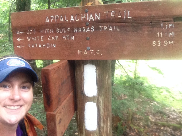
After crossing the river it became obvious that we wouldn't make it 22 miles. We reassessed our plan and decided to aim for a more manageable 17 mile day. Just before our first real climb of the day, Gulf Hagas Mountain, we came across a sign with the remaining miles to Katahdin. It was the first sign like that in hundreds of miles.
We had Katahdin on our minds all day. It is all anyone can talk about. Later in the day we would get our first view of it, we were all stoked and I think that's what kept us going most of the day. The climb up Gulf Hagas was pretty difficult. Once again, rocks, roots, and mud were to blame. They should change the state motto to, Rocks, Roots, and Mud.
The climbs up West Peak and Hay Mountains weren't as tough, but they quickly zapped the strength from our legs. I hiked most of the day with Blade. He is a lot faster than me, but anytime that he got too far a head of me, he would wait for me to catch up.
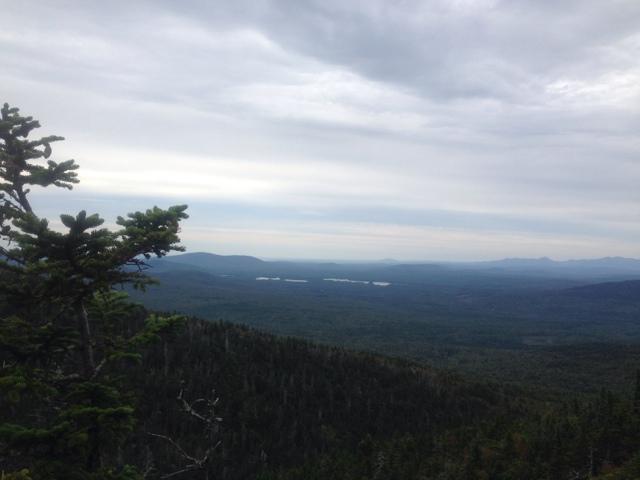
Our last real mountain until, Katahdin, was White Cap Mountain. After this we only have two more mountains left before the end and they are both under 1,500 feet. The north side of, White Cap, has the view of Katahdin, so I practically flew up the mountain. This was the moment I had been waiting for all week long, the first glimpse of my final destination. The sky was party cloudy and more than a little hazy, but I could still see her in the distance, like a beacon guiding me home.
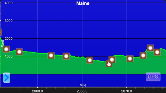
I took my afternoon snickers break staring out in the distance. It was hard to tear my eyes away. My end goal is literally within sight. Finally I had to start moving. There was a one hundred percent chance of rain tonight and I wanted to get setup before it began. The shelter area is filled way past capacity again tonight. Blade, Click, Pie, Cheese Beard, and Clarity all have a food drop being delivered early tomorrow afternoon. Poet from, Shaw's hostel, is dropping off their food resupply at one of the few forest road crossings. Laces and I elected to carry all of our food for the wilderness instead of relying on a drop. We are shooting for a 23 mile day. From here on out it should be easy hiking, except for the roots, rocks, and mud. The elevation profile looks ridiculously flat from here on out. Since it's going to rain all morning and be cold, we won't be taking any breaks. I feel like we can hit this goal.
"After more than two thousand miles on the [Appalachian] trail, you can expect to undergo some personality changes. A heightened affinity for nature infiltrates your life. Greater inner peace. Enhanced self-esteem. A quiet confidence that if I could do that, I can do and should do whatever I really want to do. More appreciation for what you have and less desire to acquire what you don’t. A childlike zest for living life to the fullest. A refusal to be embarrassed about having fun. A renewed faith in the essential goodness of humankind. And a determination to repay others for the many kindnesses you have received."
–LARRY LUXENBERG
Thursday, September 10, 2015
Day 161- The Final Marker
Sept 09, 2015
Stealth Campsite(2084.6) to Chairback Gap Lean-to(2100.7) 16.1 Miles
Have I mentioned before how much I dislike slippery, wet rocks? Let me set the record straight; I hate slippery, wet rocks. I've been really lucky with the weather lately. I can't remember the last time it rained. The consensus on the trail is that the beginning of the 100 mile wilderness is hard, but very manageable... unless it rains. Which, of course, it did last night. The first forty miles of the wilderness is over granite boulders, roots, and muddy bogs. The rain didn't make going over any of that easier.
Blade and I got up early today so that we could do an eighteen mile day. Almost as soon as we started hiking this morning one of his shoe laces decided it had had enough of hiking and broke. While he took the time to stop and repair it I hiked ahead. I made it to the Wilson Valley Lean-to shortly after. I met up with Laces and we hiked out together. Even though the trail conditions were less than ideal, we were making good time. When we reached Long Pond road we saw a sign for trail magic. Even though we were in a hurry today we took the time to checkout the trail magic. It was located a quarter of a mile off of the trail, but it was well worth the walk. We walked down the gravel road for a while, before coming to a cabin in the middle of the woods. We were offered beer and soda, so I drank an ice cold coke. While Laces, Blade, Smoke Break, and I enjoyed our drinks, Scout threw some hotdogs and hamburgers on the grill. While we ate our second breakfast, Moxie, a MTC ridge runner, gave us advice on the upcoming terrain, good stealth locations, and info on Baxter State Park. The hotdogs and hamburgers were delicious and the advice was much appreciated. Trail magic in Maine has been very infrequent, so this was fantastic.
After fueling up at the trail magic we had a sketchy stream crossing. Laces and I managed to stay dry, but Blade slipped on a rock and fell in. Half of his pack got wet and he lost a croc. Luckily, Zen was able to grab it for him before it was washed away.
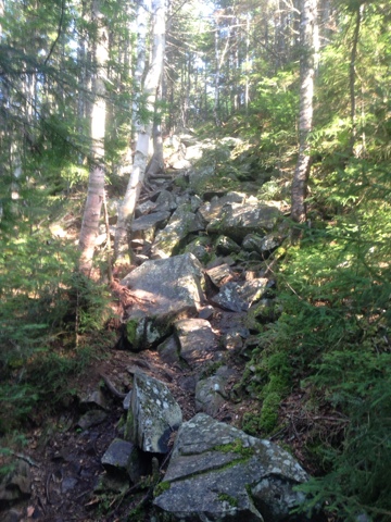
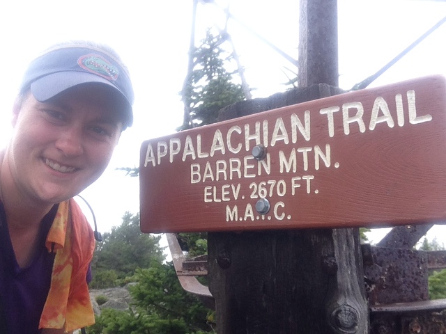
Once we were done fording the stream it was time for the climbing to begin. We had five mountains to climb today and all of them had difficult terrain. The first one on the list was, Barren Mountain. Barren had several different sections were we had to climb over granite slabs. It was steep and time consuming due to the wet conditions. Any section of dry rocks that we came across were more difficult to climb because of our wet and muddy shoes. The theme of the day was, walk through mud, slide over roots, and slip on rocks.
Unfortunately, there was no view from Barren Mountain, it was in a cloud. From there we went back down a five hundred feet, only to climb up, Fourth Mountain, for four hundred feet. Once again there was no view. Then we went back down a few hundred feet, before climbing up a few hundred feet to, Mt. Three and a Half. You guessed it, still no view, but a climb of a few hundred feet up to, Third Mountain. I'm not sure why they decided to start using numbers for mountains. I think it reflects the number of mountains in the, Chairback Mountain Range.
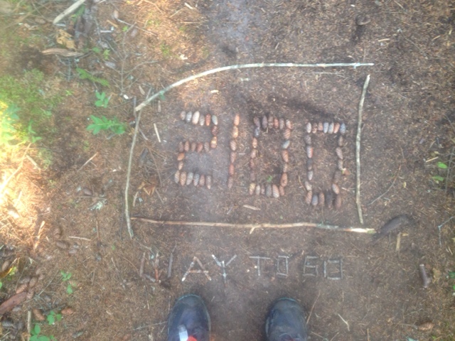
Just before the day ended, I crossed the 2,100 mile mark. It was a bittersweet moment. That was the last hundred mile mark of the journey. I got my wish, nobody else had made the sign yet, so I got to do the final one. I wanted to make it really grand, but just as I started to make it a storm rolled in. We could hear thunder really close by. I decided to go with a simple design so I could make it to camp before the storm.
After each mountain the group would sit down and take a snack break. The constant ups and downs, with no views seemed to zap our energy. I'm around so many other hikers now that I feel like I'm back in Georgia. Every time I stop, I see a parade of thru-hikers go by. Every time one of them stops, I pass them by. I've been hiking around or with, Zen, Baltimore, Burn Out, Click, Pie, Cheesebeard, Smoke Break, Clarity, Oscar Mike, Forgetful Jones, and Laces.
It is a really fun way to go through the wilderness, but it makes it difficult to find a place to camp. Tonight the shelter area is packed. It's like a tent city. I found a less than ideal spot for my hammock a few hundred feet from the shelter, next to Blades tent. Just as I finish hanging up my tarp it began to pour. It was actually raining sideways and the lightning was right overhead. For the first time in 2,100 miles my hammock and underquilt got wet. I guess I've always been lucky that the rain has never blown in before. I couldn't even cook dinner without getting wet, so I settled for a few snacks out of my foodbag instead. By the time the rain let up enough to cook, it was late. I stayed up for a while talking with Clarity and Blade. Once I finally went back to my hammock I fell asleep almost immediately. This terrain is wiping me out.
Tomorrow promises to be more of the same. Lots of ups and downs over rocks, roots, and mud puddles. I can hardly wait to get started in the morning.
"Nothing in the world can take the place of persistence. Talent will not; nothing is more common than unsuccessful men with talent. Genius will not; unrewarded genius is almost a proverb. Education alone will not; the world is full of educated derelicts. Persistence and determination alone are omnipotent."
– CALVIN COOLIDGE
Wednesday, September 9, 2015
Day 160- The Beginning Of The End
Sept 08, 2015
Monson, ME(2074.7) to Stealth campsite(2084.6) 9.9 Miles
Today marks the beginning of the end of my journey. This afternoon, after a late start, I entered into the 100 mile wilderness. I was hoping to get an early start, but that did not happen. Since yesterday was Labor Day, my final resupply package didn't arrive in Monson until 10:00 this morning. I was up by 6:30 this morning. The owner of Shaw's, Poet, offers a hiker sized breakfast for $9. We were fed three eggs, bacon, hashbrowns, and unlimitited blueberry pancakes. I wish I could have eaten more, but I just haven't been that hungry lately. I felt like a failure since I only managed to eat the eggs, bacon, hashbrowns, and one pancake. After breakfast I hung around the hostel waiting for the post office to open at 9:30. I watched most of my friends head back to the trail while I cooled my heels.
At 9:15 I walked down to the PO to check on my package. It seemed like every hiker in town was waiting on a mail drop. The woman at the PO was very busy and hadn't sorted through the new packages that had arrived. Finally around 10:30 she dug my package out and I was one step closer to heading out. I went back to Shaw's and began sorting through my food.
I'm not really sure how long it is going to take me to get through the wilderness. I've heard anywhere from 4-8 days. I do know one thing, carrying this much food is going to suck for the first few days. The 100 mile wilderness, is 100 miles without a resupply. There are no towns and only forest service roads. It is truely the only section of untouched land on the entire trail. After repackaging food and packing up my things I was ready to go at 11:30, but I had to wait for Poet to drive me back to the trail.
I didn't start hiking until 12:30. That puts a major hiccup into my plans for the week. I just started this section and I'm already behind schedule. I ran into more friends at the trailhead. I haven't seen Rocky Mountain High since Massachusetts. We hiked together for the first few miles so that we could catch up. I also saw, Forgetful Jones, Oscar Mike, and Clarity. I love the bubble I'm in right now. It's great that I will have so many friends around when I summit. I hope the majority of them will be in my group as I go through the wilderness.
The trail was pretty easy for most of the afternoon. I passed by six different ponds today. Maine is really showing off lately.
The trail was full of little ups and downs, rocks and roots, and small section of muddy and boggy trail. I really enjoyed the hiking today. It was just hard enough to feel challenged, but not so difficult that it slowed me down.
I wish I would have had more time today. It was really hot out and I could have used a dip in one of the ponds. A few miles later I passed by an amazing waterfall that I would have loved to take a snack break at, instead I took a few pictures and pushed on.
After following Little Wilson stream for half a mile we had to ford it. The water was about knee deep and the current was swift. The slick rocks should have made for a tricky crossing, but my Luna sandals are awesome. They are so grippy it's like having super glue on my feet. I made it across with no problems. The girl crossing after me wasn't as lucky. She slipped and fell in.
Blade crossing Little Wilson Stream
It was a very long, short day. It's getting dark so early now, that after our stream crossing we decided to find a spot to stealth camp at nearby. There is a huge bubble in the wilderness right now. I think 30-40 hikers entered around the same time as me today. There was a shelter .6 miles from the stream, but we figured it would be packed, so we took our chances stealthing. We didn't find the best spot, but we made due. By the time I got my hammock hung it was completely dark. I cooked dinner in the dark and then went to bed.
We are trying for a 15-18 mile day tomorrow, so it will be an early start to make that happen. I don't have any high elevation climbs tomorrow. It will mainly be several short ups and downs, like a mini roller coaster. The terrain promises to be difficult though. I've heard that this section has a ton of granite rock slabs, so hopefully the forecasted rain will hold off for a few days.
"At times, our own light goes out and is rekindled by a spark from another person. Each of us has cause to think with deep gratitude of those who have lighted the flame within us." Albert Schweitzer
Tuesday, September 8, 2015
Day 159- Where Everybody Knows Your Name
Sept 07, 2015
Moxie Bald Mountain Lean-to(2056.8) to Monson, ME(2074.7) 17.9 Miles
Last night was my second favorite campsite. I hung my hammock right next to the pond. I could hear the water breaking against the shore. Since it was a very pleasant evening I didn't use my rain tarp. I could see the stars through an opening in the trees. The loons and moose were calling out and I could hear the beavers going to work in the forest. It was a pretty magical night.
I woke up early and it was already warm out. I caught a nice sunrise over the pond before I hit the trail.
It was another easy day of hiking. The terrain was mostly flat, but there was the typical roots, rocks, and mud to trip me up.
I was making great time during the first part of the morning. The only thing that really slowed me down was my first true river ford. I had to stop and take off my shoes and socks before putting on my Luna Sandals.
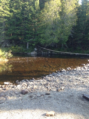
West Branch of the Piscataquis River The water was only knee deep and it felt good on my sore feet. The rope strung across the river was nice, but it was unnecessary. The water wasn't flowing very fast. Once I made it safely across I lost more time drying off my feet and putting my shoes back on. Luckily the trail stayed well behaved and I was able to cruise for several more miles. Four and a half miles later I had to cross back over the same river, but this time it was the east branch. Once again I had to remove my socks and shoes, but the river was only shin deep and barely moving.
I hustled along at a good pace for the rest of the afternoon and made it into town before two o'clock. I called Shaw's hostel from the trailhead and they came and picked me up. As soon as I arrived at the hostel I was greeted by a bunch of old friends. It seemed like everyone I knew was staying there. Rusty, Zen, Huckleberry Thug, Flick, Laces, Click, Pie, Cheesebeard, Decimal, Doubledown, Uncle D, Turbo, Shortbus, and Blade all greeted me like a long lost friend. It was amazing. We stayed outside drinking beer and catching up all afternoon. Eventually we all migrated inside to watch a Star Wars marathon!!! As my journey comes to an end I will really miss days like this.
"Acknowledging the good that you already have in your life is the foundation for all abundance."
Eckhart Tolle
Subscribe to:
Posts (Atom)

