Friday, September 14, 2018

Day 147- Victory Tour, The Official End

Monday September 10, 2018
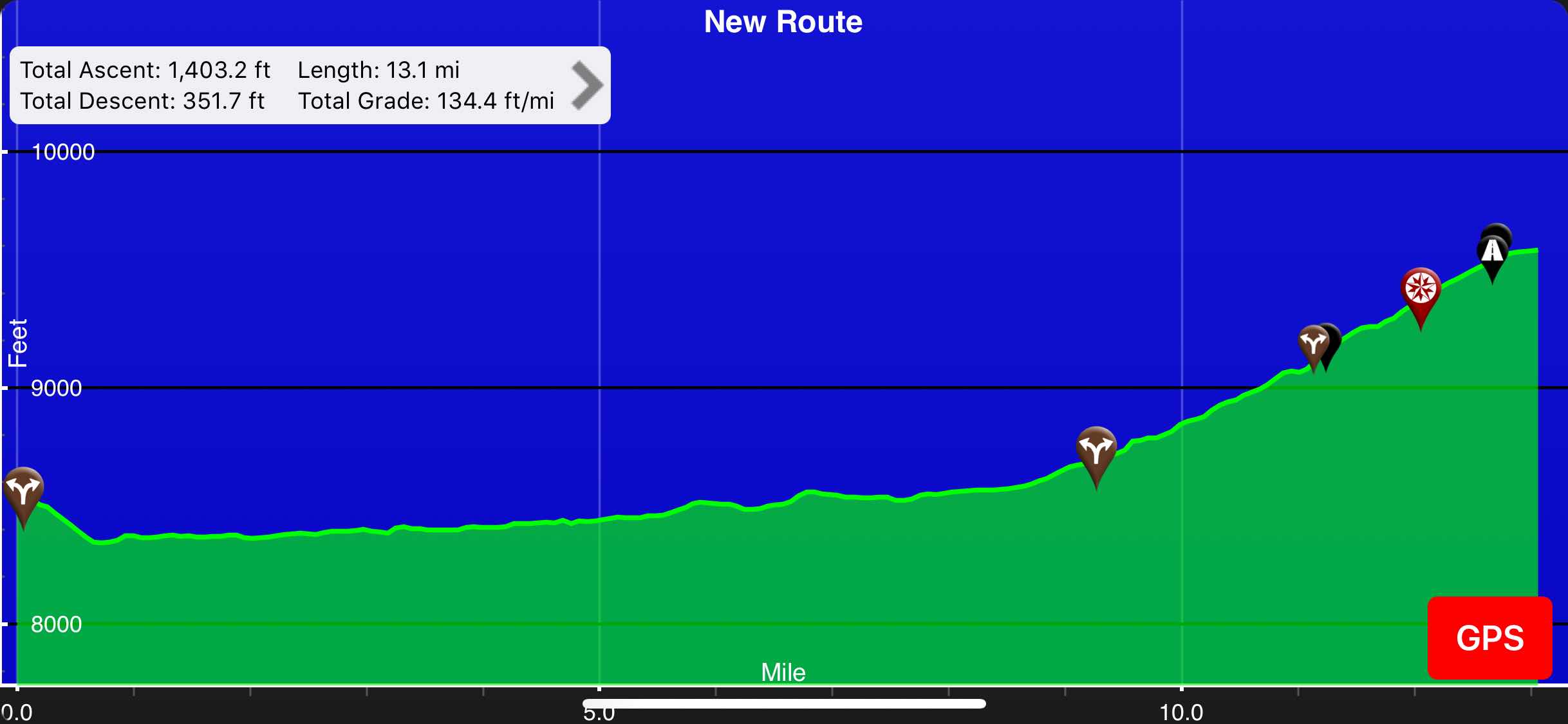
Side of CO Hwy 14(1451) to Rabbit Ears TH(1466) 
15 Miles 
Total Miles: 2,806
Elevation: 9,556 ft


Sleeping fifty yards away from a busy highway is never fun. Luckily, the traffic calmed down by the time I was done writing my blog and I was able to get to sleep. I woke up several times throughout the night. Since I was cowboy camping I took the opportunity to gaze at the stars and the Milky Way. It was such a clear night and I will miss sleeping under the stars, although I will not miss being cold all the time. With this being my last morning on trail I made sure to get up before sunrise. I took the time to make hot coffee and watch the sun rise above the mountains. I was not disappointed. The sky looked like it was on fire. 

Last sunrise of my hike

I was not terribly excited about hiking my remaining miles. I had to walk on two busy paved highways. It did however feel like a fitting end to this trail and at least I would make good time. As I left camp for the final time I had almost all of my layers on. I immediately began my 9.5 mile walk on CO Highway 14. I was pleasantly surprised to see that there was a decent sized shoulder for me to walk along. The traffic was pretty mild and the scenery was very lackluster. I made the best of the situation and put on some Disney music. Everything seems right in the world when jamming out to the Lion King, Alladin, Beauty and the Beast, and The Little Mermaid. Most of the drivers that passed moved away from the shoulder and gave me a wave on their way by. I was grateful when it began to warm up and I could finally take some layers off. 

Nine and a half miles of pavement

I was able to keep up a 3.8 mph pace on the nicely graded road. With the cooler temperatures I did not drink much water, which was a good thing. All of the water sources along my route did not look appealing. Between the cows pooping in the water and the run off from the road all of the water I passed by was brown and oily. By ten o’clock I had knocked out the nine and a half miles of CO Highway 14. I took a break next to a pull off at the intersection of CO Highway 14 and Highway 40. I ate a quick snack before I continued on. The problem with walking along a busy highway is that there is nowhere to stop and pee. 

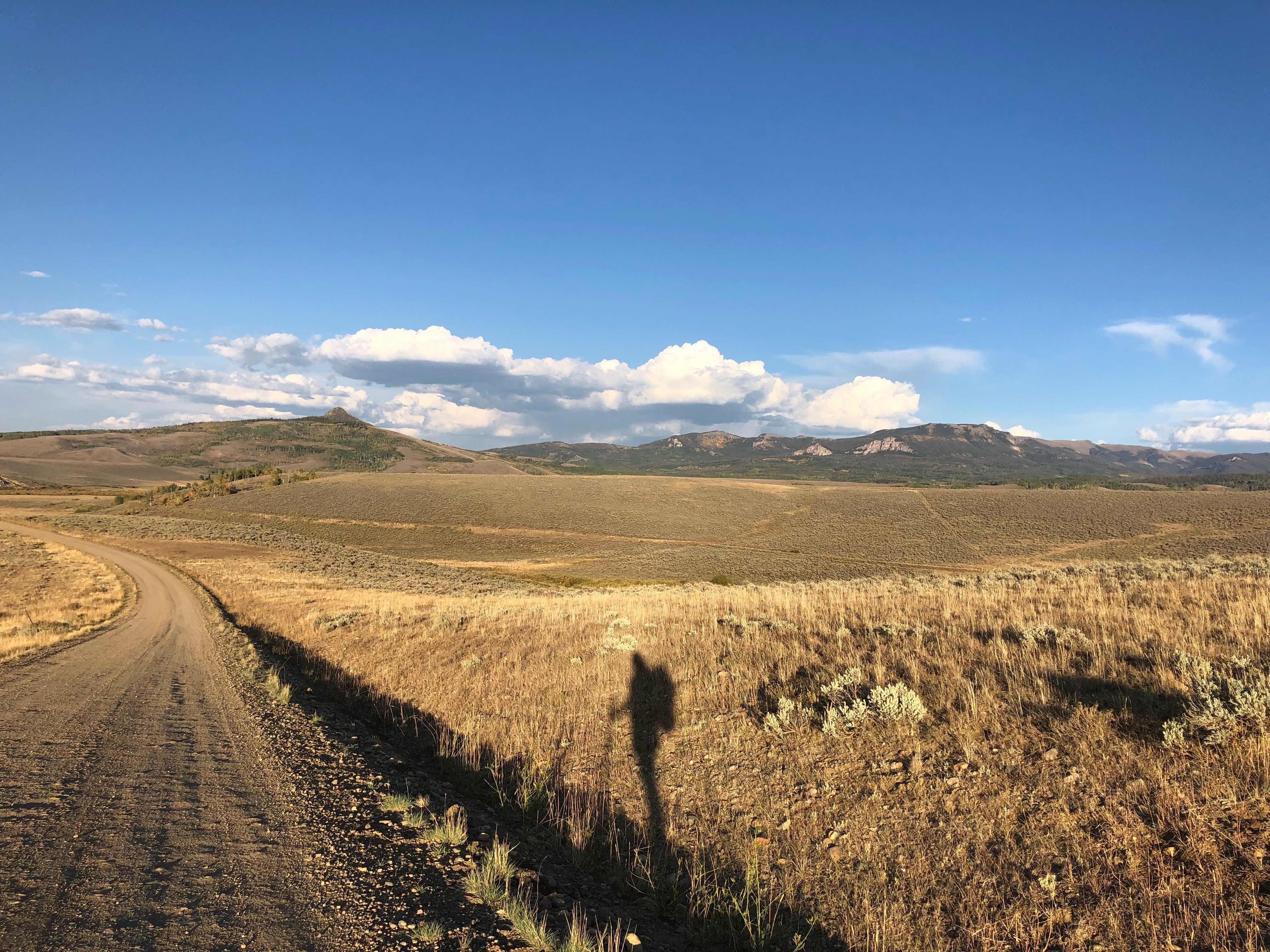
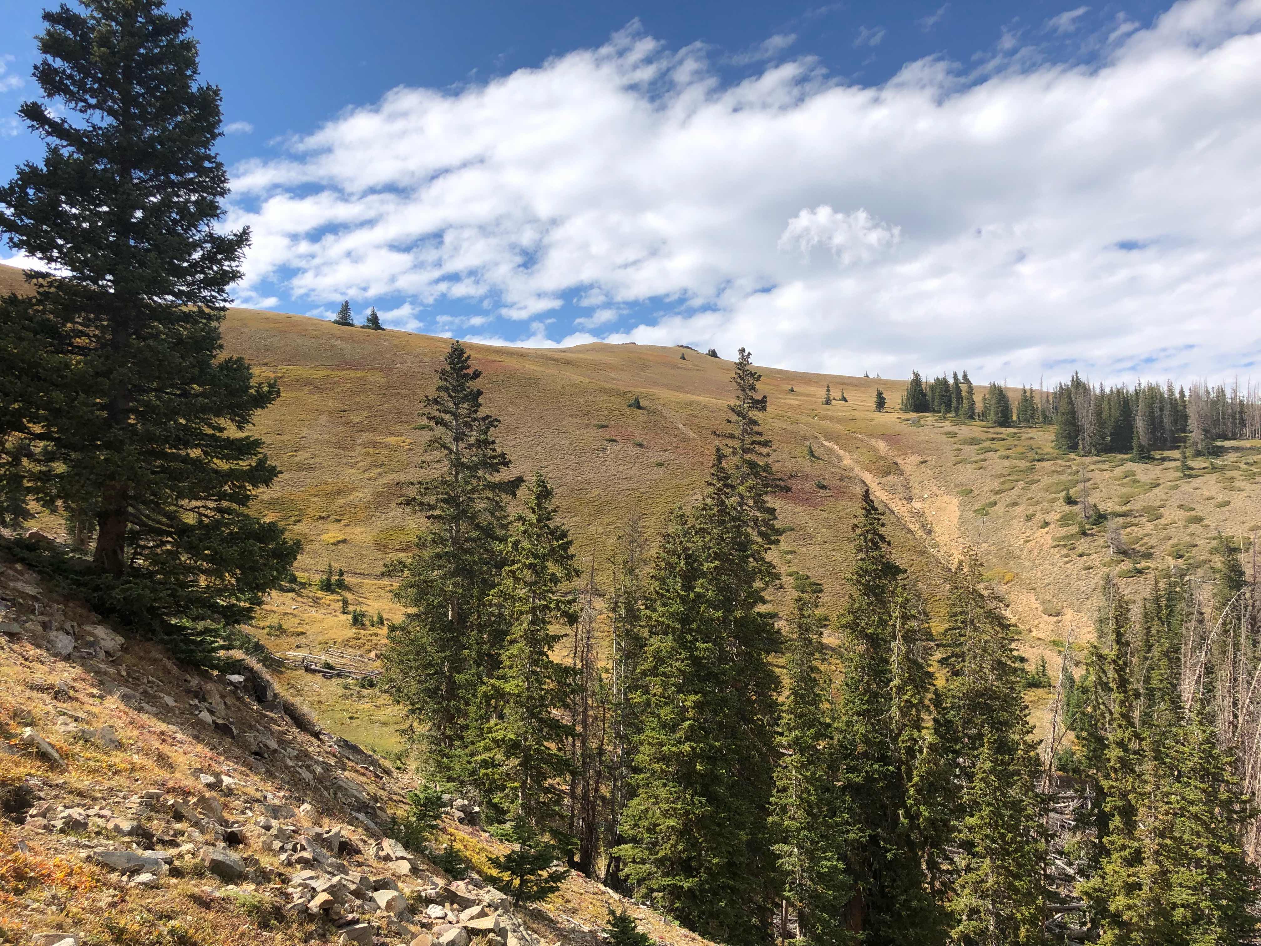
More signs of autumn 

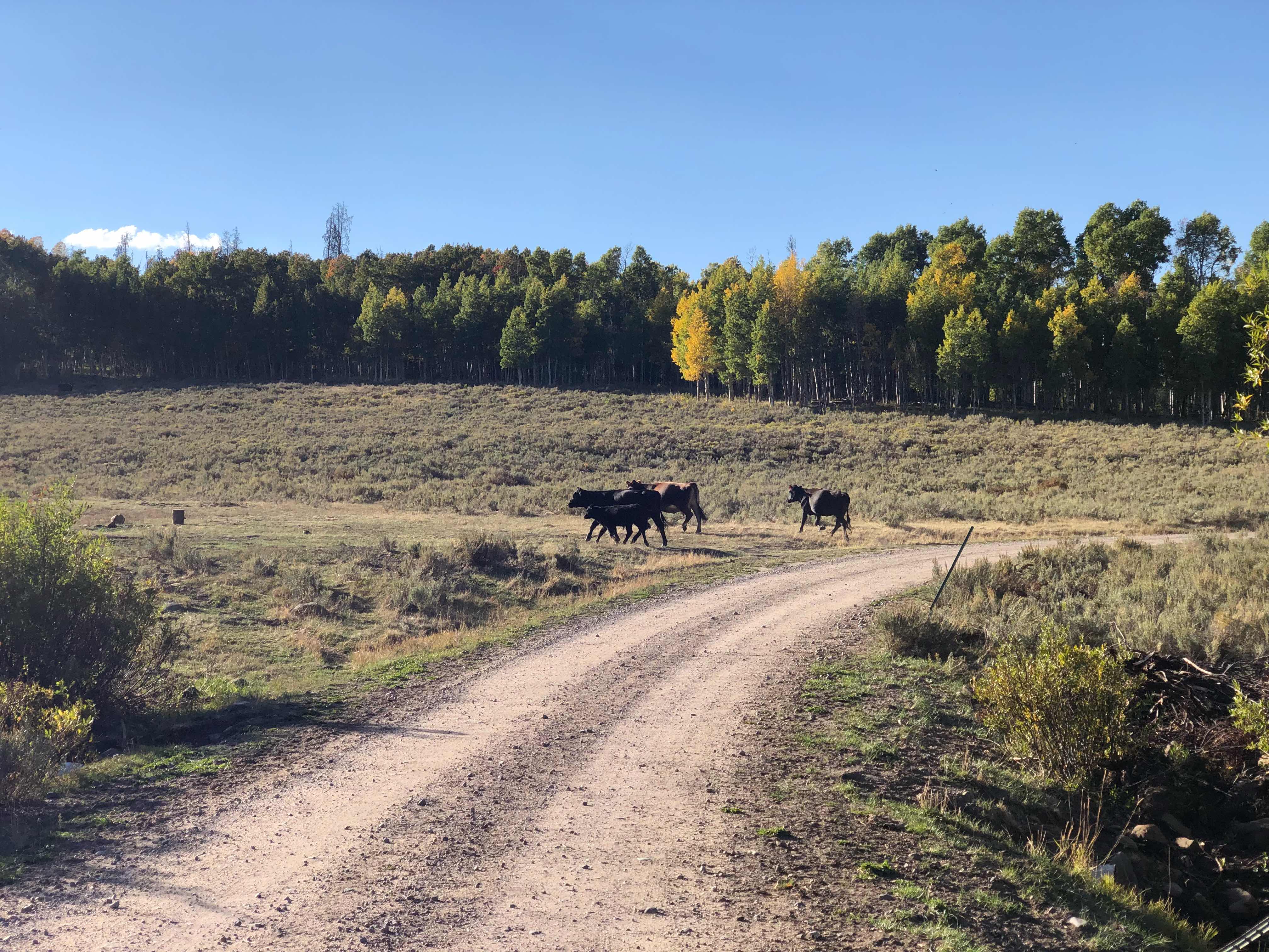
The hike along CO Highway 40 was quick and rather painless. I spent about four miles quickly walking along the shoulder. I kept my eyes open for a secluded spot where I could stop and pee, but I was out of luck. The growing pressure in my bladder helped me to pick up the pace. As I speed walked along the highway the enormity of what I was about to accomplish really began to hit home. I thought of all of the things I have seen and the people I had met. This trail challenged me in new and unexpected ways. Before I began this trail I thought I had a good idea of what I was getting myself into, after all I was an experienced thruhiker. The biggest surprise of this trail was how cold it was. I really never felt like I had a summer. There were some hot days, but the nights and early mornings were almost always cold. My second surprise was the sheer number of cows that I encountered. The Continental Divide has been overrun by cattle. It is a good thing that cows taste so delicious. They really are dumb, gross animals. There were very few days that I did not encounter a herd of cattle. 

Typical sight along the trail 

After four miles on CO Highway 40 I finally turned onto a dirt road that went into the forest. At last I could relieve my bladder. From my vantage point I could see Rabbit Ears Peak. It was nice to finally see from the road instead of a car. Last time I came this way I was skipping 100 miles of trail. This time I was completing the CDT and earning my Triple Crown. I could see the pass all day long, but as I turned off of the highway I had the perfect view of why it was named Rabbit Ears. 

Rabbit Ears Peak

After I stopped to pee I only had two miles to go before I completed my footsteps. My dirt road turned to gravel before turning into a paved road. I chatted other a hunter and a SoBo thruhiker for a short period. I really just wanted to finish so I kept the conversations short. After finishing I still had to make my way to Steamboat Springs. From there I had to figure out a way to get home. You would think that I would have figured that out ahead of time, but over the course of my long distance hiking career I have learned not to sweat these kinds of details. In the end everything always works itself out. Somewhere along my hike today I hit 2,800 miles. When I came along a leg of an elk or a deer I decided to use that in my mile marker. I have used cow poop, rocks, sticks, pine cones, and bones, but I never used pieces of a fresh corpse. It seemed fitting given all of the hunters I have passed in the last few days. 

Lower leg of an elk or deer

2,800 miles! 

As I approached the trailhead for Rabbit Ears Pass, my final destination, I passed by a beautiful groove of aspens. They had all of the autumn colors on full display. I snapped a quick picture and made my way to the monument. I was happy that my final destination had a monument of sorts. 

I hiked through spring, summer, and the beginning of fall

Ending at Rabbit Ears Trailhead was only slightly more anticlimactic than ending in a parking lot in Montana. I touched the monument and sat down. The full weight of my accomplishment had finally caught up to me. I’m not much of a crier and no tears were shed, but I was a little emotional. A car stopped to view the monument and I asked the driver to take my picture. I had to explain why it was such a big deal to be standing there. As always the driver and his wife were shocked to hear that anyone could hike that kind of distance. 

5 states, 3 National Parks, 2,806 miles hiked

Triple Crown

Awesome shirt that my parents had made for me

When I was hiking with Straws and PiƱata we frequently spoke of having hot toddies at the border in Canada. Since the weather was bad that day we did not make any. In honor of them I took the time to whip up a hot toddy. I stayed at the trailhead for almost an hour, savoring my accomplishment. Finally I decided it was time to go. I still had to hitch into Steamboat Springs. I planned on spending the night in town and then getting a rental car to drive home the next day. I had to walk about a mile to get back to Highway 40. I got a ride really quickly. A nice older guy with a giant German Shepherd stopped. He put the dog in the bed of his truck and secured her with a leash. The ride into Steamboat seemed to take forever. Stuart, my driver, was easy to talk to. He offered to let me spend the night as his house, but that didn’t seem like a good idea. I had him drop me off in the center of town. There was a burrito joint next to where I was dropped off. As I ate lunch I began to come up with a plan on how to get back to Telluride. A hotel for the night was going to set me back $150. I decided to rent a car that day and drive home. I have a new place to live in the town of Telluride so I called my new Tommy and told her to expect me that evening. I called for an Uber to drive me to the airport located 30 miles away in the town of Hayden, CO. I reserved a car for the day and before I knew it I was on the road. Driving back to Telluride was a startling change to my reality. I’m used to living life at 3 mph, not 75 mph. By the time I made it to my new home it was close to ten o’clock. The first thing I did was take a shower in my new home. All of my belongings were still in storage, which made it hard to settle in. 

New home

View from my deck

28 pounds lighter

Over the course of the next few weeks I plan on putting new content on the blog. I will do an in depth review of this hike, add some gear reviews, and as I sort through my pictures I’ll add a slideshow. Check back for new content. To everyone that has loyally followed along on this journey, thank you. If it wasn’t for you I’m not sure I would have kept up with a daily blog. Knowing that I have such loyal followers made it easier to continue on. I didn’t want to disappoint anyone. Just because I’ve finished my Triple Crown doesn’t mean that this is the end. I have several ideas of trails that I would like to hike in the future. 

Do or do not, there is no try- Master Yoda

"Don't let the fear of the time it will take to accomplish something stand in the way of your doing it. The time will pass anyway; we might just as well put that passing time to the best possible use."
—Earl Nightingale


Monday, September 10, 2018

Day 146- Victory Tour, Day Four

Sunday September 09, 2018
Haystack Mt(1420.5) to Side of CO Hwy 14(1451) 
30.5 Miles 
Total Miles: 2791
Elevation: 8,535 ft


Last night was interesting to say the least. I had just settled down to sleep when I heard a rustling sound coming from my backpack, which was just outside of my tent. At first I thought it was a bear, but that didn’t sound right. I was half asleep, but when I figured it out I jumped up. I just knew it was a mouse trying to get into my hip belt where my snacks were stored. I grabbed my headlamp and shined some light onto my pack. Sure enough I saw a mouse running away. The only thing I could really do was bring my pack into the tent with me. For several hours I would awaken to the sound of a persistent mouse trying to get into my tent. I didn’t get very much sleep. I was pleasantly surprised when I finally got up in the morning that it did not chew a hole in my tent trying to get to the food. It took me slightly longer than usual to pack up in the morning, partly because I was so tired and partly because my tent was still wet from the rain. 

Cool rocky outcrop 

I knew the first half of the day was going to be difficult. I was going to gain all of my daily elevation in those miles. I started off with a climb first thing out of camp. After that initial climb I just kept going up. I could see a big mountain in front of me and instinctively knew that I would go up it. 

Getting ready to climb some more

I usually enjoy going uphill, but the elevation has been killing me. Also this section of trail has been ridiculously steep. I’ve grown accustomed to the tourist grade trails of Glacier NP. The not so nicely graded trails of Colorado were a distant memory. Most of what I’ve been doing the last few days have been over 700 feet/mile of elevation change. Glacier was about 350 feet/mile. I resigned myself to having a very slow morning. I have to hand it to Colorado, the terrain might be difficult, but the views sure are pretty. 

Not too shabby
Clear skies 

I saw a ton of hunters out and about. There are several different hunting seasons that are open right now. I met bow hunters, rifle hunters, and muzzle loading hunters. Elk, grouse, deer, and black bears all seem to be fair game right now. Everyone I came across seemed to be wearing an orange vest, I felt out of place and was glad that it isn’t open game on hikers. I also saw a few more SoBo’s this morning. I haven’t seen so many since just after Yellowstone NP. After hiking thirteen miles of steep ups, followed by short downs I finally gained my last ridge line. On the way up I passed by my last water source for awhile and of course it was dry. I was carrying enough water that I wasn’t really concerned. I passed by another SoBo who told me that the next water source was really gross. They had seen a cow taking a poop in it. I didn’t relish the thought of having to drink from that. The last seventeen miles of the day I spent hiking on a dirt road. The only good thing about that was all of the hunting camps I passed by. I was able to successfully yogi water from the people that I passed by. No cow poop water for me! 

Random hammer cairn 

Hunter camp

Somebody had a nice view and a comfy chair

First red aspens that I’ve seen 

The rest of the day was very uneventful. The miles went by quickly, but it was very boring. I hiked by an older couple who I saw yesterday. They are section hiking the trail. They have two cars strategically placed at trailheads. They leave one car and hike to the other car. They told me where they had a car parked nine miles ahead. They had left a gallon of water next to it. The car was perfectly placed where I wanted to end my day. That water would save me from having to drink cow poop water. Today was really like a highlight reel of the Continental Divide Trail. I hiked up steep ridges, complete with strong wind, I crawled under a barbed wire fence, lost the trail several times, witnessed a cow pooping in a water source, walked on a dirt road, saw a well blazed trail that was not the cdt, and camped in sagebrush next to a busy highway. I think that sums up this trail nicely. Tomorrow I even get to walk my last thirteen miles on a paved, busy highway, with little to no shoulder. 

Moo

Shadow photography 

Last sunset on the Cowtinental Divide Trail 

“Do the right thing. It will gratify some people and astonish the rest.”
- Mark Twain


Sunday, September 9, 2018

Day 145- Victory Tour, Day Three

Saturday September 08, 2018
Bowen Creek(1394.5) to Haystack Mt(1420.5) 
26 miles 
Total Miles: 2760.5
Elevation: 10,200 ft


I am not adapting to this elevation very well. I was utterly exhausted last night, but I slept fitfully. I was up at six o’clock and left camp just before seven. I was not looking forward to starting the day off with a big climb. Small climbs were giving me difficulties yesterday. I was pleasantly surprised to find that this climb went pretty well. I didn’t do it quite as fast as normal, but it definitely went better than yesterday. I could see someone in front of me and I think that gave me extra motivation to catch up. Early on I stopped to take off a few layers. I got about a quarter mile down the trail after stopping when I noticed that my sunglasses were gone. I hoped that they had fallen off when I stopped to change and not back where I had camped. I dropped my pack and ran back to where I had stopped. The force was with me and my glasses were there. Phew! I would have been really mad if I had to go all the way back to where I had camped. 

Sun almost reaching me

Isolated color change due to the fact that all of the other trees are dead

I was really hoping to hit thirty miles today, but I was really off pace to hit that goal. The trail went steeply down and wove around in the forest. Eventually I hit an ATV track. I was hoping to gain some time, but the track was rocky and I had to work hard to keep my footing. I caught up to the person that was ahead of me at the top of the climb. We said a brief hello. He passed me a little while later when I stopped to pee, then I passed him when he stopped to filter water. This went on for most of the morning. We never said more than hey or how’s it going. 

ATV track

Weaving through the forest 

I planned on stopping for lunch at a trailhead parking lot/highway. The trail was going up and down very steeply and I couldn’t eat my snacks as I hiked. I was losing energy quickly due to a lack of calories. I probably should have just stopped and eaten, but I didn’t want to lose my momentum. I really misjudged how close I was to the trailhead. By the time I stopped it was after noon and I had only had a granola bar and a snickers. When I got to the road I took everything out of my pack so that my gear would dry. My sleeping bag and stuff sacks had gotten wet with condensation and frost over night. I made a burrito with mustard, mayo, pepperoni, sharp cheddar cheese, and some honey mustard flavored pretzel pieces. I washed that down with some caffeinated flavored water. As I was eating the guy I had leapfrogged with all morning caught up. His name was Whitney Houston. He has hiked the AT and PCT. due to his work schedule he is section hiking the CDT. He said he gets in close to two hundred miles a year. We chatted for a little while longer, but eventually he continued on and I stayed to finish my lunch. I had also seen two SoBo hikers earlier in the day. They have a lot of high elevation miles ahead of them and not much time left before the weather turns. I’m glad I’m not in that boat this year. 

Fall is here and winter is coming 

After lunch I really hit the wall. I had a horrible 800 foot/mile climb in front of me. I have had plenty of similar climbs on this trail, but not in a long time. Montana really ruined me, I haven’t been at elevation since the Wind River Range and I don’t think that was above 11,000 feet. Today’s climb would take me up to almost 12,500 feet. The six mile climb took me forever. In my top form I’m capable of doing a climb like that in two hours, today it took me close to four hours. I’m embarrassed to say that I had to stop several times on the way up. I can’t remember the last time I had to take a break while climbing a mountain. 

First part of the climb(easy part)

Second part(still not too bad)

Third and fourth part(kicked my butt)

Yup still going, fifth section

Sixth and final section

Looking back from the top

Took a break in the hut to eat a snack out of the wind

Added my graffiti next to my friends and found where trail legend Amish left her mark in 2006(I would never leave graffiti behind, but this spot encourages hikers to sign) 

I wish I could have lingered at the top longer, but the wind was picking up and clouds were moving in. I totally forgot that the sunsets at 7:24 here. I only had 2.5 hrs to hike another seven miles. Usually that is not a problem, but I haven’t exactly been setting speed records the last few days. As I hiked down from the ridge it began to sprinkle. What the heck? I had literally just checked the weather and there was a zero percent chance of rain for tonight. Ugh! I picked up my pace and the rain stopped. I thought everything was downhill for the next seven miles, but once again I was mistaken. I dropped a quick 1,200 feet of elevation, then proceeded to gain about 600 feet right back. I was really tired, but the threat of rain, lack of water, and the approaching sunset kept me moving. 

Cool view from the top

Looking back. I walked the ridge from the left to right 

I forgot how challenging Colorado can be. I was glad that I got off of the ridge before it really began to storm. I realized that there was no way I was going to make it to my planned campsite before dark. I had chosen that spot because it was the only listed water. I had just under a liter of water left. I figured I could use it to cook dinner with and have about a quarter of a liter to drink. That was nowhere near enough, but I didn’t see another way. I didn’t want to get to camp after sunset and setup camp, cook, and eat in the dark. As I dropped down from the final section of the ridge it began to rain again. I put on my rain jacket and was resigned to the fact that I was going to get to camp wet. I decided to camp in the first sheltered spot that I came across. Unfortunately, when I found that spot someone else was already there. I got to meet yet another southbounder by the name of Quadzilla. I said a quick hello, we exchanged names, and as I was hiking away he told me about an unlisted water source one mile away. I was very thankful for that info. I had just enough time and daylight to make it that far. As I was making my way down the mountain and to the water I heard someone call out my name. They were far enough away that I couldn’t immediately tell who it was. I was pretty sure that I didn’t know any other thruhikers in this area. As I got closer I saw that it was LETITBE. We crossed paths way back in Dubois, WY. He joined Z, my parents, and I for breakfast. It was cool to see a friendly face that I knew. He congratulated me on my triple crown. He somehow knew that I was in the area making up missed miles and was hoping to run into me today. We didn’t talk for long since it was raining and we both needed to get into camp. I wished him well on the rest of his hike. 

LETITBE 

I found the unlisted water source right next to the trail. I grabbed a few liters as quickly as possible. Now all I needed to do was find some flat ground to camp on. It didn’t take me too long to find what I was looking for. I set up my tent and just as I crawled inside it began to rain again. I hadn’t planned on cooking dinner from inside my tent, but with the rain increasing that is exactly what I did. Thank god I’m no longer in grizzly territory. Hopefully tomorrow goes a little more smoothly. 

“I follow three rules: Do the right thing, do the best you can, and always show people you care.”
- Lou Holtz


Saturday, September 8, 2018

Day 144- Victory Tour, Day Two

Friday September 07, 2018
Grand Lake(1365) to Bowen Creek( 1394.5) 
22.1 Miles
Total Miles: 2,734.5
Elevation: 10,220 ft


Last nights lack of sleep, my being completely dehydrated, the increase in elevation, and my total lack of motivation made for a very difficult day. I decided to skip hiking the official cdt in Rocky Mountain National Park. I didn’t think that I could hike all 26 miles before dark with my late start. Instead I hiked a few side trails in the park, creating my own unofficial loop. I didn’t leave the hostel until after ten thirty. I hiked the official cdt for about four miles before I split off to hike my own alternate. The trail in the park was nicely maintained and graded very well. Even with the nice trail I struggled to make miles. I climbed up to 10,000 feet in elevation almost immediately. I definitely haven’t been that high since the Wind River Range in Wyoming. I felt off balance all day long. My body seems to think that it no longer has to cooperate with my mind since it has already hiked to Canada. I struggled to convince it to play nicely. I had zero energy and no matter what I tried I couldn’t find any motivation. The scenery was very ho-hum as well, so that didn’t help to improve my mood. I resigned myself to the fact that it would be a very long day. 

Idyllic stream in RMNP

Big mountains ahead

I enjoyed creating my own trail and getting off of the beaten path. I was surprised by how many day hikers I came across. I figured since Labor Day weekend had come and gone the park wouldn’t be as busy. Most of the people I talked to had no idea what the CDT was. A few of the people I met just assumed I was out on a day hike as well. It was like they had never heard of backpacking before. I would think that my pack would be a giant indicator that I wasn’t just out for a few hours. I hiked through several trailhead parking lots. They all had trash cans and I deposited my snack wrappers at each and everyone. I also took full advantage of two privies along my route. 

Nearing the headwaters of the Colorado

I could see some very big mountains in the distance and I knew that I would have to climb up and over one of them. I knocked out the first ten miles of the day relatively quickly, but I struggled for the last ten. I was stopping every two to three miles. I’m hoping that my body readjusts to the altitude quickly, but I think that by the time I’m adjusted thus victory tour will be over. I had left over pizza for lunch today. It was one of the few times this entire trail that I have packed out town food. Since I wasn’t very hungry, due to elevation and dehydration, I decided to save the pizza for dinner. I went through most of my snacks late in the day. I was hoping that my returning appetite meant that I was getting rehydrated. Late in the day I had to make a critical decision. I had to hike another three miles and almost 2,500 feet of elevation or stop well before sunset. I didn’t relish the thought of camping above 11,000 feet, so I decided to stop early. That will make for a more difficult day tomorrow, but I think I made the right decision to stop early. I’m used to the sun setting at 8:30, but in Colorado it sets at 7:30. I made camp, collected water, ate my pizza, and wrote yesterday’s blog before it got dark. 

Strange tree stump artistry in the woods

Exited RMNP and entered the Never Summer Wilderness 

Too nice of s campsite to walk past 

View from camp

I really hope that tomorrow is a better day. I might not have my high elevation lungs anymore, but I am a Jedi Master now. I’m pretty sure I can push through this difficulty and finish strong. 

“With integrity, you have nothing to fear, since you have nothing to hide. With integrity, you will do the right thing, so you will have no guilt.”
- Zig Ziglar