Thursday, May 31, 2018

Day 47- The One With The All You Can Eat Thai Buffet

Thursday May 31, 2018
BLM Parking Area(1619.8) to Rawlins, WY(1629.1) 9.3 Miles
Total Miles: 814.7
Elevation: 6,700 feet


As soon as the gun enthusiasts left last night I was able to finish writing my blog and go to sleep. The moon was so bright I felt like there was a spotlight on me. It was the first time in forever that I was able to cowboy camp(sleep without setting up my tent). I really enjoy cowboy camping, but anytime it is cold or rain is threatening I setup my tent. I slept fitfully again due to the wind and moon. At least the wind helped with the mosquitoes. I like waking up and getting started really early on town days. I was up by 4:30 and hiking by 5:15. 

Dawn by the salt water lake

We started the morning off with a ridiculously steep, but short climb. That is how I like starting my day. It really gets the blood pumping. The hike into town was easy and uneventful. We made it into the city of Rawlins, Wyoming around 8:15. This is one of the larger towns we have gone through. I believe the population is around 10,000 people. The trail went right through town, which is always a bonus. We found a really nice EconoLodge about 1.5 miles off of the trail. This 1-star hotel has a restaurant, bar, laundry, and a barber shop on site. It is also close to the grocery store and a diner. 

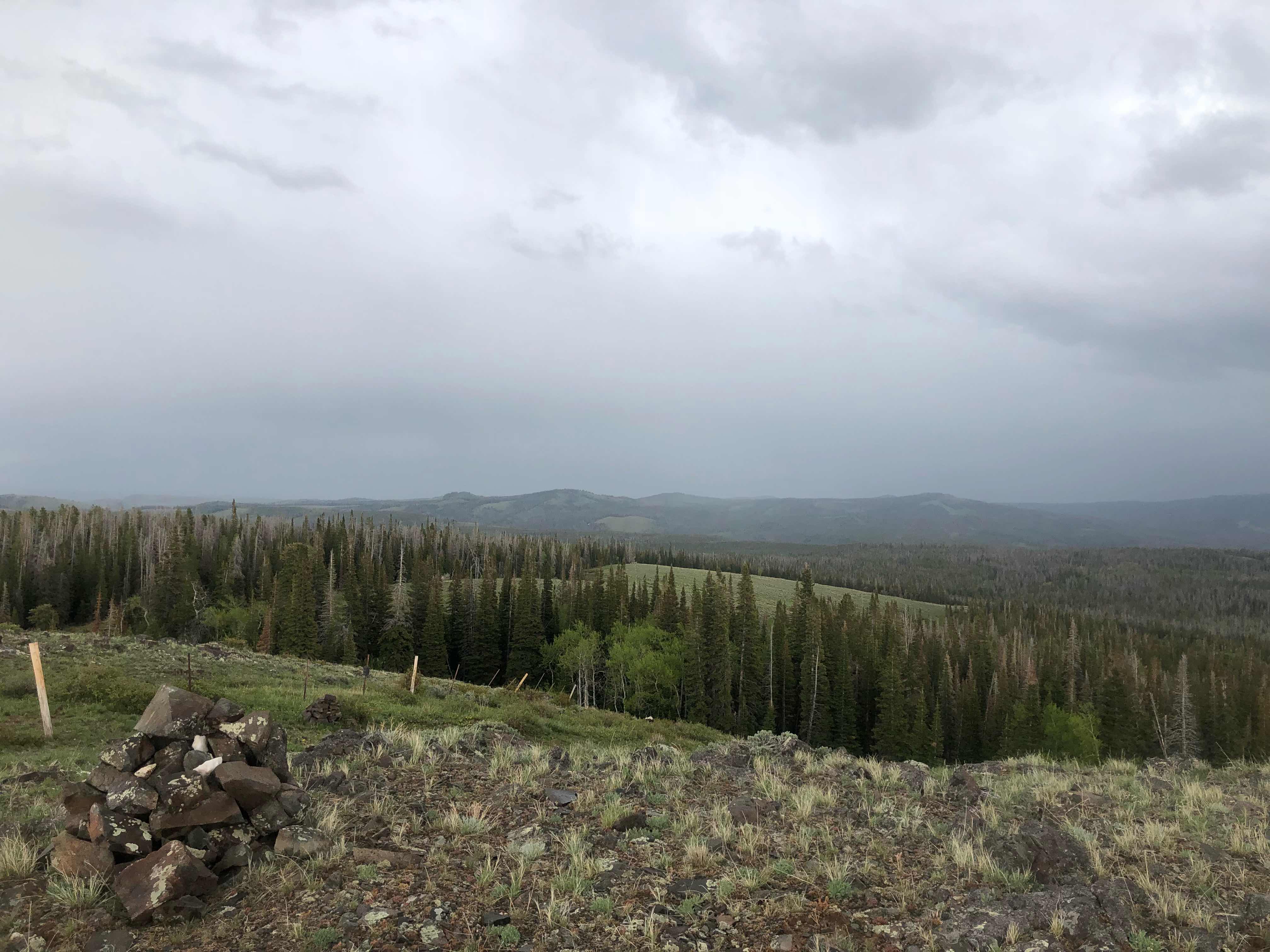
Sunrise from the top of our short climb

We were able to check into the motel as soon as we arrived. Our room wasn’t actually clean yet, but we were able to leave our packs while we went for breakfast. The diner we chose to eat at was just ok. This was my first mediocre breakfast of the trail. The lack of quality was made up by the portion size. I had a breakfast skillet, coffee, and a few glasses of non-salty water. 

Ok at best

We stopped to pick up a few beers on the way back to the motel. Turtle likes to drink a beer while he showers and I have adopted the practice. Once we had showered, I started our laundry. Laundry on site is always a nice feature. I only hike with one set of clothes and it can be awkward to sit around in a laundromat wearing rain gear. Our clothing was really muddy and filthy after this stretch so we did two wash cycles. While the laundry was going I caught up on my social media and made plans for my food for the next leg. We have 121 miles to hike before heading back to Colorado. I had to change my rental car reservation since we are running one day behind schedule. The eleven miles of additional trail we had to hike set us a little behind. Once those chores were accomplished we decided to walk to the other side of town for an all you can eat(AYCE) thai food buffet. Turtle also needed to pick up his new backpack from the post office. It was 3.2 miles round trip. I never enjoy walking non-trail miles. We tried to get and Uber or bus, but there wasn’t one. 

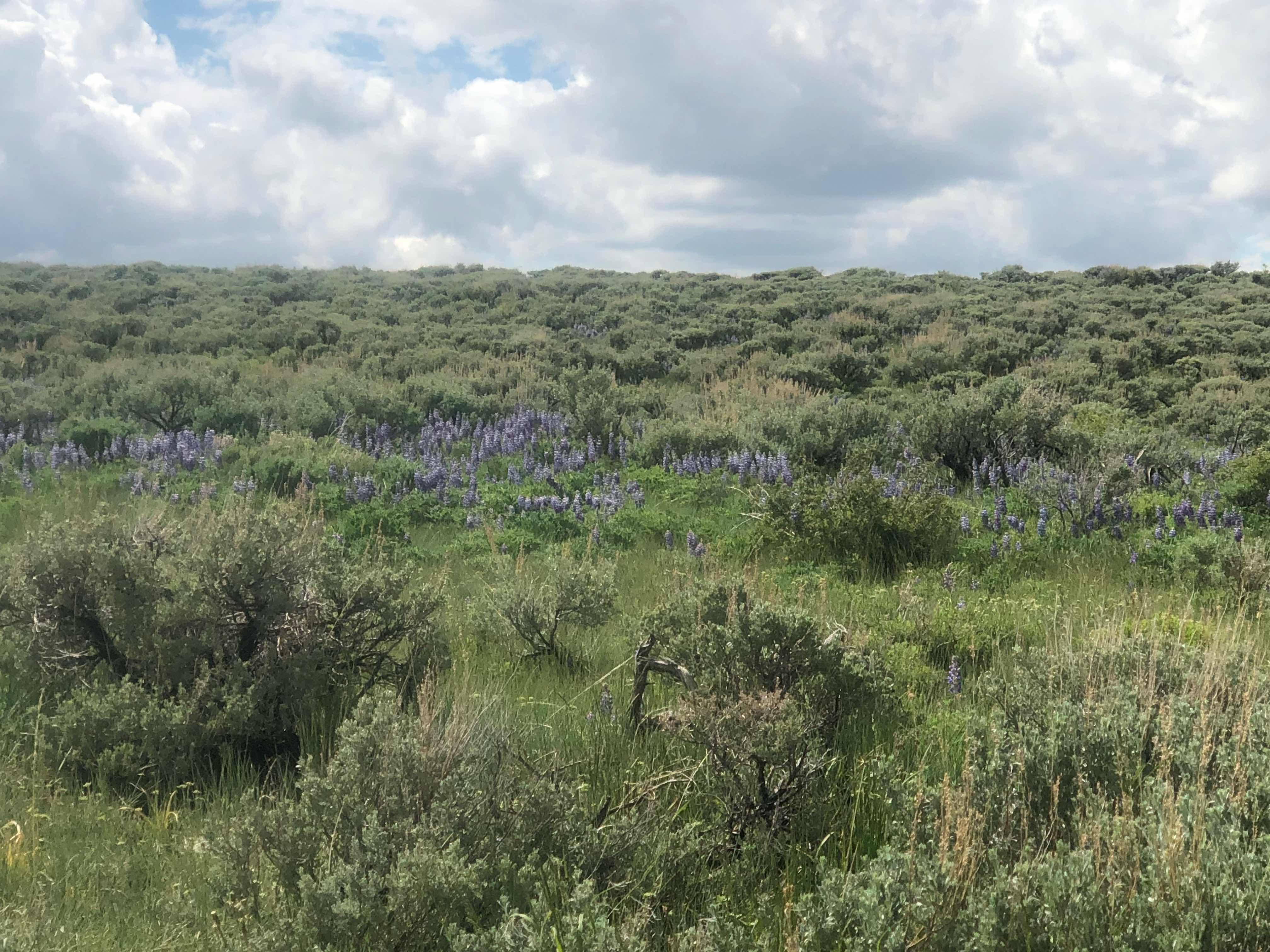
Were we camped last night

The AYCE buffet was just alright. Some of the items were really good, but I thought most of it was average. Once again the quantity of food made up for the quality. I have pretty high expectations for my thai food. Tampa has a few out of this world thai restaurants. Cortez, CO has one of the best thai restaurants in America and I try to eat there once or twice per season. We ate until we were stuffed and then ate some more.  I waddled over to the post office with Turtle. His new backpack had arrived. It is a little different from his old pack, so I hope it works out for him. I’m just glad it has a working hip belt. Carrying 20-40 pounds on your shoulders can’t be a fun experience. 

After lunch I called my parents to check in. Apparently my delayed posting of the blog has some people concerned. I’m lucky to have had such good cell phone service along this trail to post my blog every day or two. I don’t expect that to continue for long. If you are ever worried about my lack of posts you can check my progress on the home page of the blog. There is a tab called “Where is Yoda”.  My InReach personal locator tracks me as I hike. I usually set it up to send out a signal every 30 minutes. I also check in at camp every night. All of this data is transferred to a map on this tab. Feel free to check it out. 

After talking to my parents I went to the grocery store to resupply. I think I have just enough food to make it through this section. I am carrying an extra dinner and a few extra bars just in case we get slowed down for some reason, but I don’t think that will be an issue in this section. The great divide basin is really flat and we will be hiking mainly on dirt roads. There is no snow. No trees blown down to slow us up. Plus this area doesn’t get a whole lot of rain. We should be able to just cruise before heading back to Colorado. I’m really trying out new foods. I’m pretty sick and tired of the usual hiker fare. I’m still eating the staples of ramen, granola bars, snickers, and m&m’s, but I have added in a few new things. Mangas got me hooked on bagel chips. I dropped my nightly Oreos in favor of freeze dried fruit. I haven’t had tuna packages since the AT, but I bought a few for this leg. I also got a summer sausage. I’m really excited for a new dinner option. I bought some shelf stable tortellini and a package of pesto seasoning. I’m going to try to make pesto tortellini. I hope it turns out ok, because it is a little heavier than ramen or mac and cheese. 

I’m looking forward to knocking off this section before heading back to Colorado. The Basin is notorious for being extremely hot, sunny, and not a lot of shade. I’m really happy we are doing it now instead of in the beginning of July. 

“A grateful heart is a beginning of greatness. It is an expression of humility. It is a foundation for the development of such virtues as prayer, faith, courage, contentment, happiness, love, and well-being.”
- James E. Faust


Day 46- Castaway

Wednesday May 30, 2018
Muddy Creek(1594.6) to Parking Area(1619.8) 25.3 Miles
Total: 805.4
Elevation: 7,172


I woke up just before dawn this morning. I felt water dripping on my face and was convinced that the rain had returned. I groggily open up my tent and saw clear skies. Turns out that frost had collected on my tent and that caused a ton of condensation to build up inside. I decided to pack up as quickly as possible so my stuff wouldn’t get wet. I didn’t sleep very well. I’m not sure why, but I kept waking up and it would take me a while to fall back to sleep. I had a coyote visit me around 1:30. It was only about 10 yards away. As soon as it heard me it ran away. 

View from my tent 

Turtle and I were so excited to have good weather this morning. It was really a moral boost. We made quick work of the first 5.5 miles of the day. We expected to hit a water source, but it was dry. It wasn’t a big deal, but it was disconcerting. We hiked about another mile to find that source dry as well. We figured that with the recent rains these sources would be rock solid. Usually we have a water report to help guide us, but since we flipped farther north I’m pretty sure we are the first hikers of the season to come through this area. We still had plenty of water to last us awhile and the area has more than a few natural ground water sources. The issue is that all of the ground water in this area has a very high salt content. The further we hike, the more saline water we come across. The saline ranges from barely drinkable to ocean level ranges. We were forced to carry and drink some of the barely drinkable water. I felt like a castaway. Water all around, but not able to drink it. We will carry and drink this water for almost 30 miles. The more of it I drank today the thirstier I felt. It was like eating a jumbo movie theater popcorn. I can taste the salt on my lips and nothing quenches my thirst. 

Huge heard of cows

The terrain changed rapidly during the hike today. The early morning felt very lush with lots of wildflowers and greenery. The farther I hiked,  the more desert like it became. We walked along a dirt road for close to 20 miles. It was hard to keep my mind engaged in the hike. I quickly grew bored. I saw the same view practically all day. At first it was awesome, but after hours of it I was less impressed. The one super cool thing is how often I see Pronghorn antelope. I was excited for this section primarily because of the chance to see the fastest land animal in North America. They are very skittish animals. I haven’t been able to get a picture because I never get within 300 yards before they run away. Late in the day I finally had two who didn’t run from me. I got within 50 yards and they just stared at me. It was pretty cool. 

Pair of pronghorn antelope 

Since Turtle and I had a definitive campsite in mind we hiked separately. I have really enjoyed hiking with him, but I also like to hike alone. After the rough few weeks we have had I put on my favorite audiobook, Harry Potter, and just cruised. The Harry Potter series read by Jim Dale always puts a smile on my face. The miles just flew by. Even the crappy salty water couldn’t bring me down. 

First 5 miles of my day

5 more miles

Saline pond 5 miles later

Around mile 19. Big difference to how my day started

The Sand Hills

Can anyone tell me about this plant. It looked like it had grapes growing

Dry pond. See all of the residual salt?

I ended the day at a BLM parking area. Turtle and I were so stoked to have pit toilets, picnic tables, and trash cans. When I arrived some locals were using the sheltered picnic table area as a gun range. I went over to say hello and to try to yogi(get food or drinks from someone without out right asking for said item) some water. The guys didn’t catch on. I didn’t get water or a good vibe from then. I walked back the way I had come to another area with picnic tables. I felt better when Turtle showed up a few minutes later. We cooked and ate dinner while they had target practice. We wanted to setup camp where they were shooting their guns. Eventually they left, but another larger group showed up. They were much more obnoxious. They had loud, crappy music playing and were burning trash while shooting. We eventually set up camp where we had eaten. The location isn’t ideal because of the salt water pond right next to us. The mosquitos are really swarming. As I’m writing this it is after 10, the gunfire is sporadic, the music is still loud and crappy, and I’m being eaten alive while drinking salt water. At least it didn’t rain today. I finally got a picture of some antelope. I’ll be in town tomorrow. Also I finally hit the 800 mile mark. 

I use whatever is available at the moment. There was cow poop aplenty. 

“Even when we have physical hardships, we can be very happy.”
- Dalai Lama


Day 45- Slip and Slide

Tuesday May 29, 2018
Old Road(1573) to Muddy Creek(1594.6) 21.6 Miles
Total Miles: 780.1 
Elevation: 7,132 feet


I awoke bright and early to the sound of rain battering on my tent. Shortly after Turtle called out saying we should wait to pack up. He had a weather report saying it should clear up by 9. I couldn’t go back to sleep for awhile. I listened to it rain steadily for about an hour. The rain varied from a downpour to hardly a drizzle. Every time I thought about calling out to Turtle so we could pack up, the rain increased. Around 8am I finally drifted off to sleep. I woke back up just before 9. It was only sprinkling, so I suggested that we get going. As soon as we emerged from our tents the rain increased. We really thought it would stop around 9 or 10, so we went ahead and packed up. We didn’t start hiking until almost 10. For the next 2.5 hours we hiked through a steady downpour. To make matters more interesting we were completely out in the open and it was windy. Hiking in the rain is utterly demoralizing. It almost seems like the end of the world. I had to draw strength from my experiences on the Appalachian Trail. I knew that it wouldn’t last forever and eventually things would get better. We finally got a break around 6 miles into the day. The rain stopped and we found a sheltered spot to take a break. 
Our refuge didn’t last long. Within a few miles it started raining again. It really seemed like it might rain all day long. I had my phone safely put away to protect it from the elements. As the ferocity of the clouds increased, moral plummeted. To make matters more interesting, this section of trail is completely on dirt roads. After our 37 mile paved road walk into Grants New Mexico, I thought I had made peace with walking on dirt roads. They are much kinder to my feet than paved roads. After today we are once again at odds. Dirt roads + rain= a slide and slide. I slipped and fell walking down one. Turtle started to laugh at me just as he hit a slick spot and also fell down. HaHa... Vindication! 
After about 12 miles of walking through the rain, up and down muddy slippery roads the rain finally stopped. The sun even came out for awhile. That is when a new problem arose. The mud started really clinging to our shoes. It would build up to a crazy level before breaking free. Each and every step we would collect more mud. I swear it felt like we had on weighted shoes. At times it was like walking with 5 pound lead weights on each foot. 

Insane amount of mud

The rest of the day proceeded with stormy looking clouds surrounding us. Sometimes we would get sprinkled on for awhile and once or twice it surpassed a drizzle. The real bummer was today should have been glorious. I really enjoyed the scenery and the wildflowers are really going off right now. Much of my attention was diverted to my footing or keeping my head down to keep the rain out of my face. Even with the late start and rainy conditions it felt great to finally make some miles again. I can’t remember the last time I hiked more than 20 miles in one day. 
The weather should be better tomorrow and I’m really looking forward to dryer roads. 

Dreary day

Getting better

Idyllic landscapes 

Dodged these clouds

Took refuge under a bridge for 15 minutes trying to stay dry late in the day

Home sweet home

We ended the day dry. It looked like we were going to get soaked again within the last 3 miles, but we only got sprinkled on. We found a great spot to camp at. There was a broken down structure of some kind that made a great platform to cook and eat on. I was thrilled not to have to sit in the mud to cook or eat. Just as I finished cooking it started to rain, but it only lasted 30 seconds. I’m glad I had my AT experience to fall back on today. I think I would have been even more dejected had I not lived through many much worse situations on that trail. Here is hoping for a dry day tomorrow. We haven’t had much of a break with weather or trail conditions since leaving Chama. I could really use a dry and easy day. 

“Worrying does not empty tomorrow of its troubles, it empties today of its strength.”
 –Corrie Ten Boom


Day 44- Bad Medicine

Monday May 28, 2018
Top of a Snowy Ridge(1554.1) to Old Road(1573.0) 18.9 Miles
Total Miles: 758.5
Elevation:7,936.8 feet


So today was another great day in Medicine Bow National Forest. If you like postholing for mile after mile, followed by mile after mile of walking through forests with trees down everywhere, and huge thunderstorms then this would have been your kind of day. Turtle and I didn’t even bother setting an alarm this morning. We decided to start hiking whenever we woke up. We were both up and moving around 5:30. The days are getting really long. There was enough light to wake me up at 5:30 and it didn’t get full dark until almost 9 pm. We postholed for about 5 more miles. At one point we had to stop because my feet were so cold I was nervous there would be permanent damage. I’ve never felt pain like that before. It was crazy. We didn’t get out of the snow until Deep Jack Trailhead. That is significant because we were originally supposed to start our flip there yesterday. 

Snow as far as the eye can see

Nice to know that we were on trail

Finally out of the snow

The last mile of snow was probably the worst. The area it covered was full of downed trees. Every time I fell through the snow I was terrified about what lay below. It would have been really easy to break an ankle or leg. Luckily we made it through unscathed. We were both ecstatic to finally reach unblemished trail. The ecstasy only lasted a few moments. We entered into a new type of frustration, blow downs. Every time we would hit our stride we would come across a tree fallen across the trail. Don’t get me wrong, it was much better than the area we had left behind. Just as we cleared a major area of downed trees it began to drizzle. We could hear thunder from all directions and the sky looked ominous. The rain never got to the drenching stage. It was more of a heavy drizzle. We went in and out of the downed trees. 

The only picture of the area I took due to the rain

Once the rain stopped we came out into the open for awhile. We crossed numerous dirt roads and the trail was relatively difficult to find at times. We passed by some amazing areas where the wildflowers were out on display. They were mixed in among sage bushes. Even though the trail was hard to find this was my favorite part of the day. 

Wildflower extravaganza 

Crazy tree created long ago by the Ute Indians. Thanks for the info on these trees Jo Lynne Spalletta


Can anyone tell me what these are? They were my favorite today


Clearing skies?

After the wildflower section the trail did a very AT thing. We could have followed the mountain ridge at a low elevation, but instead we climbed 4 different peaks before dropping back to almost where we started from. The peaks had good views, but the trail design was suspect in my opinion. 

Four random peaks we climbed

After the PUD’s(pointless up and downs) we descended sharply onto a dirt road. We have officially finished with Medicine Bow Wilderness and I believe we are on the cusp of the Great Divide Basin. I say cusp because I don’t think it has actually started yet. Almost as soon as we started down the road the skies opened up and unleashed hell upon us. Luckily, we had dropped down to 8,000 feet in elevation, but in no time I was soaked and freezing. The last few miles of the day were not happy miles. Stopping to set up camp at the end of a long, tiring, and difficult day soaked to the bone is not fun. You would have thought I would be an expert at this after the Appalachian Trail, but that seems like such a distant memory. Turtle and I stopped to grab some water from a nearby stream and even that little task seemed torturous in the rain. The saving grace was that just before we stopped for the night the rain quit. I was able to get setup and keep most of my gear dry. I’m really hoping for a better day tomorrow. I didn’t expect my first two days of this leg to start off like this. 

Camped amongst the sage. Crazy storm clouds in the distance

"And once the storm is over, you won't remember how you made it through, how you managed to survive. You won't even be sure whether the storm is really over. But one thing is certain. When you come out of the storm, you won't be the same person who walked in. That's what this storm's all about."
―Haruki Murakami


Monday, May 28, 2018

Day 40-43 The Flip

Thursday-Sunday May 24-27, 2018
WY Highway 70(1546.4) to Top of a snowy ridge(1554.1) 7.7 Miles
Total Miles: 739.6
Elevation 10, 656 feet


I promise you I haven’t been just sitting idle. Once the decision was made to flip up to Wyoming there was a ton of logistical details to iron out. I made the decision to combine 4 days of blog posts into one post. Mainly because there is only so much I can talk about what I have eaten. I made the decision to head up to the Great Divide Basin of Wyoming because it is the only part of the trail that I haven’t hiked that is not covered in snow. Once Turtle and I hike the Basin we will rent a car and head back to Colorado. This flip will give us almost two weeks to allow for the snow to melt in Colorado. It also allows us to get through the Basin before the temperatures become truly uncomfortable. 

Thursday afternoon was spent lounging around in Pagosa Springs. Mangas’s wife was coming to pick him up and agreed to give Turtle and I a ride as well. We had breakfast at The Rose again and it was great. Just as we were finishing up, Hopeful, another thruhiker joined us. He is braver than I and was heading back to the trail later that evening. Mangas and I went by the post office after breakfast. I had 5 packages there that contained all over my cold weather gear. What I would have done to have had those boxes before leaving Chama. I made arraignments for the P.O. to hold the boxes until I return. I headed back to the hotel to finish laundry and to pack up. The rest of the afternoon was spent st the local bakery. Mangas’s wife, Julie picked us up around 3. We went back to the PO to pick up a package for Turtle, but it hadn’t come in yet. That was a bummer for him as it contained a new backpack. The one he is hiking with is in a sorry state. The buckle for his hip belt is broken and one of the shoulder straps is getting ready to break. 

Colorado Columbine

The drive home took a little over 3 hours. Turtle and I got dropped off in Telluride, while Mangas and Julie continued on to Ridgeway/Ouray. It was great and weird to go home. I had to give up my apartment, but my friend Seth let us stay with him. Turtle and I went to the hotel I work at for dinner. Since the summer season just started the bar and restaurant were slow. We had a great time at the bar with my friend Ethan taking care of us. I also got to see some of my friends which was fantastic. After dinner I took Turtle to our local bar. We had a fun night while waiting for Seth to finish with work. We ended up staying up until 3 in the morning. 

Ethan’s beard is better than most thruhikers 

Even though we stayed up so late we still managed to get up around 9. Seth, Turtle, and I went to breakfast before going into Telluride. We shopped at a few outfitters and wandered the town. Eventually Seth had to go to work so Turtle and I went to a few restaurants for lunch and so Turtle could try a few of the ladies cal beers. I got to see a few more of my friends. We really wanted to stay out and have a few more drinks, but we were exhausted after the late night. We decided to head back to Seth’s to take a nap before going back out. Unfortunately our nap turned into us sleeping all night. 

Traditional Telluride picture

Town of Telluride snuggled in a box canyon

It is crazy to see the difference between the southern San Juan mountains and the San Juan mountains of Telluride. Nobody in Telluride could believe that it got off trail because of snow levels. On Saturday we went to lunch nah with Seth and he drove us to Mangas’s house in Ridgeway/Ouray. Seth really went out and f his way to help us out and I can’t begin to express how much it meant to me. Thanks, buddy!

Mangas’s house was incredible and I really enjoyed seeing him in his home environment. We hung out for awhile before going into town for dinner. We went to Taco del Gnar, which is one of my favorite places to eat. They have the best tacos ever. After dinner we went for ice cream at a local shop. Mangas’s tenant and Hugh school friend Mike joined us for the night out in the town. I enjoyed spending time with Mantas’s friend and wife. After dinner we went back to the house and watched a movie. It should have been an early night, but I was anxious and didn’t sleep well. 

We woke up this morning and hit the road a lot Tyler after 6. I cannot believe Mangas offered to drive us all the way to Wyoming. That is the main reason this entire plan was feasible. Thanks Mangas. 
As with all plans it is important to be flexible. We were 10 miles from the trailhead when we hit a closed road. We couldn’t get to where we wanted to start our he trail because elk calving season had the road closed. Ironically elk calving season is why Telluride has a 7 week offseason and I get to collect unemployment. I guess you win some and you lose some. The best option going forward was to get dropped off 11 miles farther south. The only problem is that area still has snow and goes to 11,000 feet. 

Trailhead at WY Highway 70

This area was really our only option. Turtle and I had high hopes that it wouldn’t be too bad. We started hiking at 1:30 and spent the next 6 hours postholing and walking in snow. Have I mentioned how exhausting that is? On the bright side nothing about the hike was sketchy or dangerous. We should only have another 5 or 6 rough Miles tomorrow. Hopefully my feet and toes will thaw out eventually. After almost 8 miles of postholing in snow my toes are still numb. We are camped at the top of a ridge and it is very cold and windy. With dry ground at a premium we didn’t want to take the chance of hiking past this less than ideal location and not finding anything else. I really struggled today. The lack of sleep, alcohol consumption, and 3 zero days have really taken a toll on my body and mind. Starting my monthly cycle sure didn’t help things either. Tomorrow is a new day and pretty soon the snow will be a distant memory. I sure when I sweating my butt off in the Great Basin I will miss the snow. 

This was literally my entire hike

Seriously 

Snow for mile after mile

And more after that

The forecast tomorrow is calling for thunderstorms. I’m really hoping we manage to dodge them all day. Even though we are already behind schedule we don’t mind. The longer this section takes us, the longer the snow in Colorado has to melt. 

"Rest is not idleness, and to lie sometimes on the grass under trees on a summer's day, listening to the murmur of the water, or watching the clouds float across the sky, is by no means a waste of time."
- John Lubbock


Wednesday, May 23, 2018

Day 39- Making Plans

Wednesday May 23, 2018
Forest Rd 380 to Highway 160- 12 Miles
Total Miles: 731.9 
Elevation: 7,320 feet


What a difference a day can make. After we made our decision to bail on the high route through the San Juans life has really improved. This is not how I imagined this hike going, but on the cdt you have to be flexible. I didn’t get much sleep last night. My mind was working overtime trying to figure out how to proceed from here. I don’t feel like I can hike any farther into Colorado right now. I don’t want to just sit in town and wait for the snow to melt. I’m considering a complicated flip flop. A flip flop is where you move(flip) to a different section of the trail, hike that section, then go back to where you left off(flop) and continue hiking again. I was up most of the night weighing my options. The only thing I had figured out this morning was that I was really tired because I didn’t sleep. 
Mangas and I left camp at 5 am so we could get to town early. It was another cold morning, but with the prospect of town ahead of us we didn’t seem to mind. Since we were out of the cold, wet, snowy ground we really weren’t that cold. The miles seemed to fly by. We hiked to highway 160 by 9:15. From there we had a 35 mile hitch into town. Turtle got to the road over an hour ahead of us and had no luck getting a ride. It is well known that women hikers have better luck securing a hitch so the guys hung back and I stepped up to the road. We waited about another 45 minutes before a pickup truck finally stopped. Mangas and I rode in the front of the truck and Turtle jumped into the bed. The man who gave us a ride, I can’t remember his name, was really nice. We chatted amicably for the drive into town. 

Elk posing for the camera

Middle stage of beetle kill on this pine tree

Pretty hike for a gravel road

Once into town we immediately found a place for breakfast. If you ever find yourself in Pagosa Springs, CO for breakfast I highly recommend The Rose. The staff was friendly, the portions were ginormous, and for a resort town the prices were fair. I ordered my favorite breakfast meal, a burrito. I also wanted some hash browns so I ordered a side as well. When my breakfast burrito was delivered I was shocked to see that it was the size of a newborn baby. I am proud to say that after 5 days of decreased calories, extremely hard physical workouts, and cold temperatures my hiker hunger kicked in big time. I ate the whole burrito and most of the giant plate of hash browns. 

Normal sized fork for scale 

Once our hunger was satisfied we went in search of lodging. Turtle and I had different priorities for lodging than Mangas. Turtle and I split a room so price wasn’t as much of a concern, but we wanted onsite laundry. Mangas got his own room so a cheaper price was key. We ended up about 2 blocks away from each other. It is with great sadness that I have to announce that Mangas has officially called it quits on his section hike. He had originally planned on hiking through Colorado, but with these conditions and being a local he can come back out when things improve. I will really miss his company, zen like attitude, and encyclopedic knowledge. 

Mangas on day 1

After we checked in to the hotel we got our laundry started and I made some phone calls. My parents sounded very relieved to hear from me. I tried to assure them that I was fine, just humbled and a little shaken from my recent experiences. Turtle and I, with help from Mangas started to develop a plan to move forward. When I have a better idea of what we decide I will let you know. We planned while our laundry finished and then went out to a brewery for dinner. The Riff Raff brewery was pretty darn good. I had a few delicious jalapeƱo margaritas. The menu had a theme going from the movie The Big Lebowski. I had The Dude burger and added a Walter. It was a burger with cheddar cheese, carmelized onions, garlic aioli, and bacon. Making it a Walter added bbq shredded pork. It was fantastic. We also split some bbq pork nachos. Dinner really hit the spot. 

Trail cairn in front of a message parlor that uses marijuana infused oils. We are definitely in Colorado

The rest of the night went by quickly. Turtle and I have really been studying our maps to come up with a viable option to move forward safely. Hopefully tomorrow I can update you with a fully fledged plan. 

"Unfortunately, we can never truly know if we're making the right decision. What we do know is that wherever we are, that's where the Light wants us to be. It's the best place for us to be now. And as long as we don't try to control the situation, then we won't end up in the place we shouldn't be."
-!Yehuda Berg