Showing posts with label triple crown. Show all posts

Wednesday, April 25, 2018

Day 10- My Pain Gives Me Strength

Tuesday April 24, 2018
Bear Creek(5.1) to Bank of the Gila River( 23.0) 17.9 
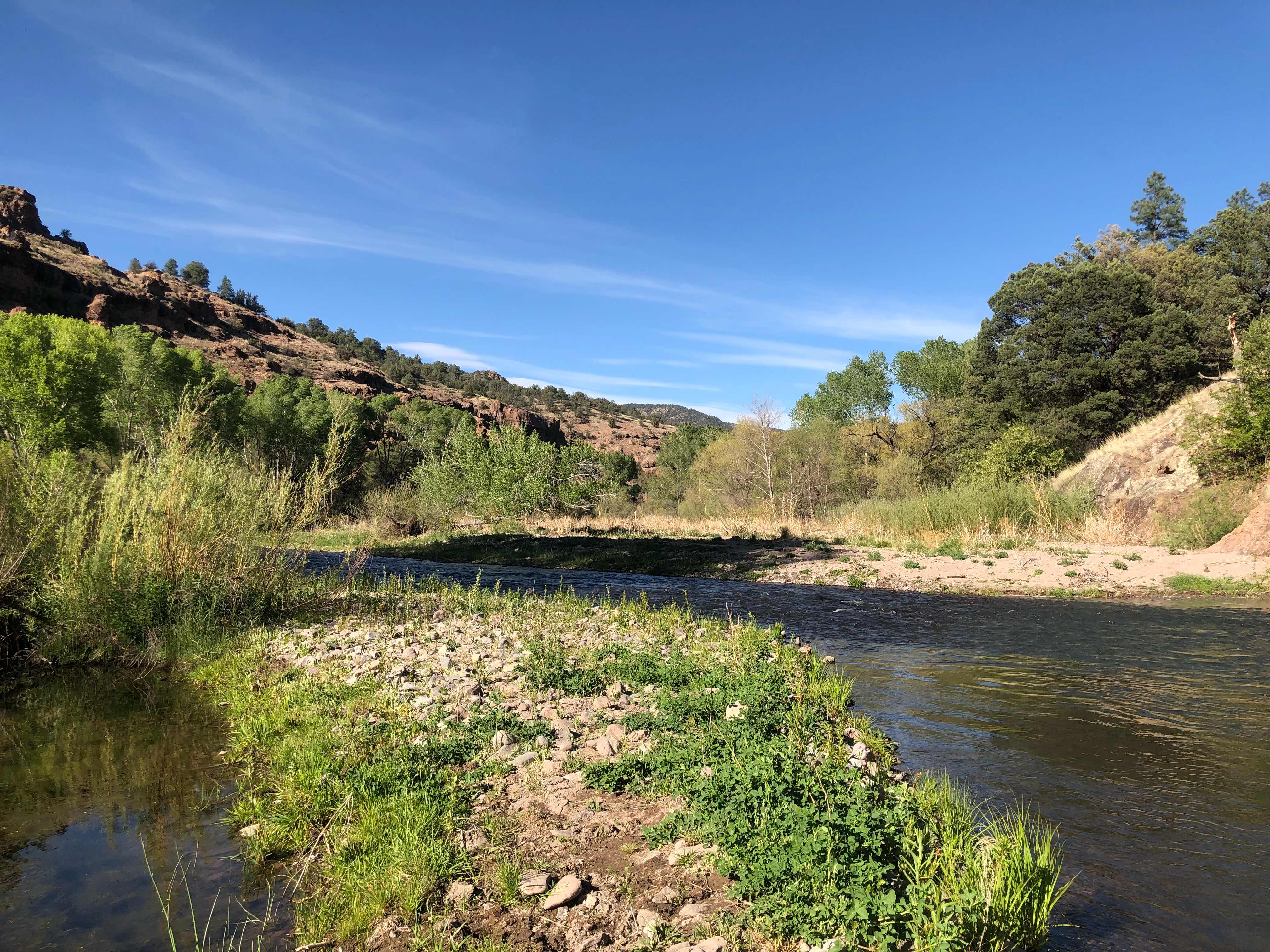
Gila River
Total miles hiked to date: 163

Sorry, but I have no data on my elevation change. Best estimate is around 4,000 ft gained and about 4,700 ft lost. Apparently whenever I take an alternate route Guthook doesn’t let me know the elevation profile. 

The plan for today was to tale it easy so my ankle/foot could have a chance to heal. Well sometimes the trail provides, but today it did not. For most of the hike I was in Struggle City, population 1. Luckily, my ankle behaved for most of the day. The trail just decided to try and out do the Appalachian Trail I terms of steep climbs and long downs. My legs are not quite up to the task yet. The morning started out ok. It was cold last night and early this morning. That caused me to leave camp about twenty minutes later than normal. Then I had to stop on my way out for water. I was expecting a 16 mile dry stretch so I carried two liters out of camp. I was dumbfounded to find water almost every four miles today. I guess the silver lining was that I didn’t have to stop for any until much later in the day. Just before hitting a proper trail I passed my an old mining operation of some kind. Sites such as these are really common where I live. 

Perhaps a silver mine

My ankle began to ache after only a few easy miles. I was really beginning to think that I was in trouble. I had visions of only making it 10 miles and being in agony the entire hike. That was right about the time the trail started to climb. For some reason my ankle doesn’t hurt at all when I’m climbing. That leads me to believe that I have a problem with my hamstring and/or calf. I had 3 distinct climbs to tackle today. Each was harder than the one before. One of the reasons I enjoy thruhiking so much is for the physical challenge. Well today I got my money’s worth. 

Old house I’m thinking about buying lol

The first climb was up a combination dirt road/very old undefined trail. Every time I got into a rhythm I had to stop and check my map to see if I was going the right way. Whenever you have to stop in the middle of a climb you lose all momentum. I gained close to a 1,000 feet over two miles. I was rewarded at the top with a nice view and more importantly, cell phone reception. I took a break to get my blog posted from yesterday and to stretch. I’ve been doing this long enough to realize that what goes up must come down. So far any loss of elevation really really hurts. Today was better than yesterday, but not by much. However, the force was with me and the trail didn’t descend too far. 

Nice view at the top 

The next climb was a lot steeper and longer. By my calculations I gained 1,700 ft of elevation over 2.5 miles. This one was straight up, but very well marked. A lot of this portion was really reminiscent of the AT. I never had a climb like this on the Pct. There were sections that definitely were not graded for pack animals. My pace was very much affected. I was only averaging 2 mph and had to take frequent breaks. I hope I have more days like this. I needed all of the training I can get before Colorado. Once I reached the top I walked at tree line for awhile. The trail was almost over marked by cairns, very un-cdt like. 

Cairns as far as the eye can see

There was also a trail register at the top. I was able to see how far ahead some of the people I know are. Baskets and Constantine are at least two days ahead of me. We started on the same day and road to the monument together. I was hoping I was getting closer to them, but they seem to really be pulling ahead. Mike P, who I met on day 4, is 3 days ahead. I really hope he can pull of a continuous year triple crown. I haven’t seen another hiker in 3 days now. Out of my original group that I started with, 3 people are ahead of me and everyone else is at least 1 day behind. I seem to be in my own little bubble. I was hoping to not be in a crowd on this hike, but I never really believed I wouldn’t have anyone else around. 

The regis-tree. The log was in an actual mailbox. So cool 

I got a small reprieve from going uphill as the trail followed the contours of the mountain for several more miles. Most of this section was through a pine forest. Once again it was reminiscent of the AT. 

Pine trees 

Now the fun part of the day began. By this time I was completely exhausted, but my spirits were still high. I had to cross over one more canyon before dropping down to the Gila River. This last bit was a bitch. It wasn’t particularly steep, but is was completely overgrown. Imagine climbing up the stairs in your house, except the stairway is full of stabby branches. This was my life for over an hour. I had to fight for every uphill step. Plus it was very exposed. The sun was really beating down on me. Whenever I have a difficult climb I listen to music to help see me through. When I’m particularly miserable I like to listen to Les Miserables. Don’t ask me why? I guess I find it uplifting. 

Trail through Manzanita 

At first I became very excited to see manzanita on this trail. I have very many fond memories of it on the Pct. Casa da Luna had an entire camping area comprised of manzanita. I became distinctly less enthusiastic when inhad to hike trough it going uphill. Once I cleared this area my legs were pretty torn up and Les Miserables was over. I put my music on shuffle and pressed on. I knew that I had to drop down over 2,500 ft before I reached the Gila River. What I didn’t realize that it would be down a steep and rocky dirt Jeep road. Up until this point I had completely forgotten that my ankle was hurt. I was quickly reminded. The next 4 miles was difficult, slow, and excruciating. 

Four long miles of this

To be far, my ankle did much better today than yesterday. I think all of the uphill today helped to stretch out my calf and hamstrings. Whenever I took a break I did some more stretches and that seemed to temporarily solve the problem. By the time I got to the bottom of the canyon I was in desperate need of water and a break. Lucky for me I finally hit the Gila River. I will spend the next 60ish miles hiking along it. I cross the river over 85 times. Today I didn’t want to get my shoes wet so late in the day, so I put on my Luna sandals and hiked in those until I made camp. The ice cold water did miracles for my ankle. 
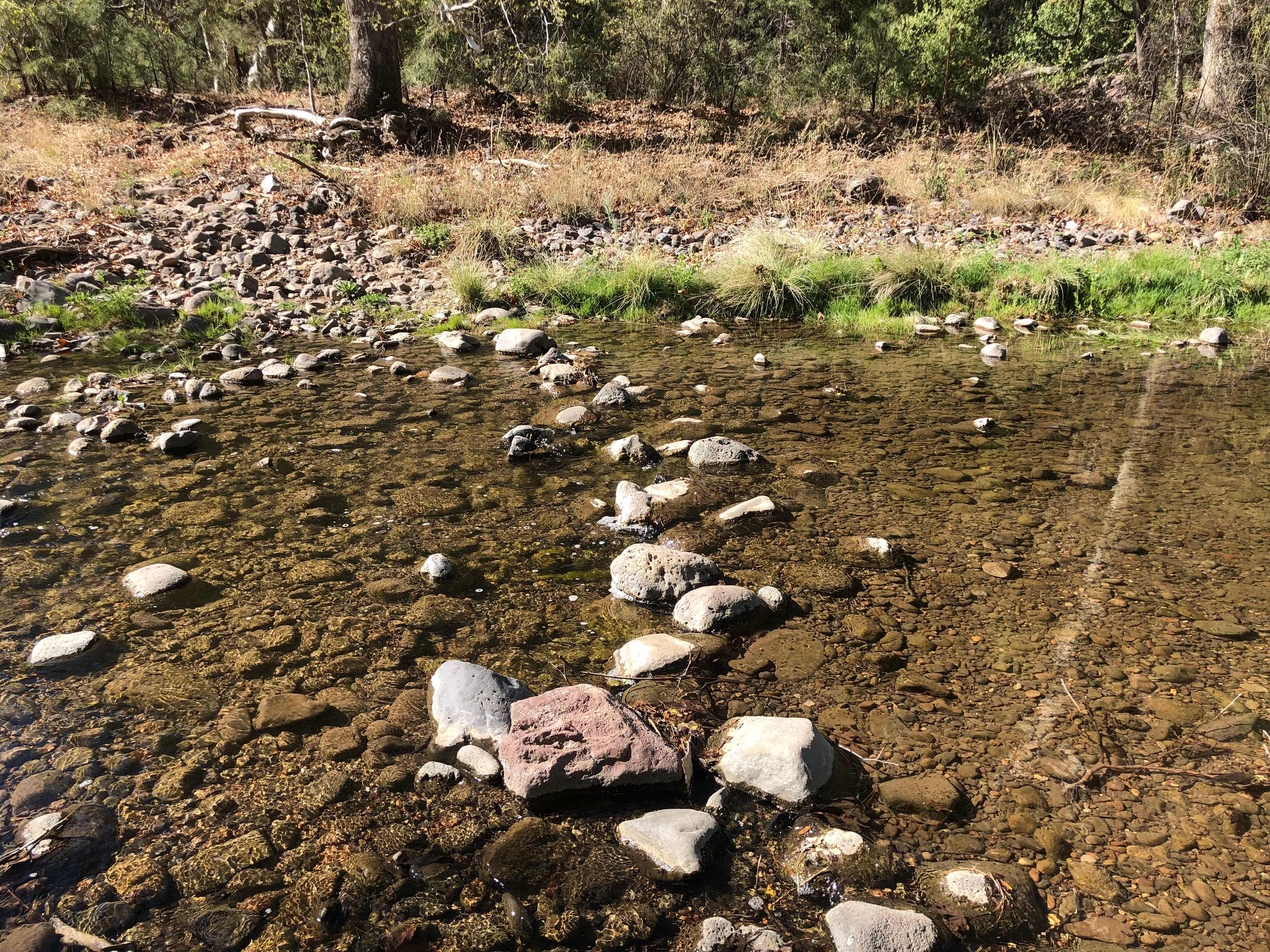
Started of with a nice easy dry crossing

Too wide for a dry crossing. I just went for it and walked upstream for awhile

This area is going to be beautiful(and slow going)

I spent awhile trying to find an acceptable place to camp. Most places on the banks were marshy or giant anthills. After bushwhacking for over a mile I finally found a descent spot. I decided to set up my tent tonight. I thought it would be really cold with a ton of mosquitoes since I was so close to the river. So far I was wrong. I haven’t seen a single mosquito and it is pretty warm still. I’m hoping it doesn’t get too cold tonight. I’m not looking forward to being cold in the morning and then having to hike in and out of the river all day. My plan is to sleep in and let it warm up. I only have 15 miles before I get to Doc Campbell’s Outpost, my next resupply point. I forgot to mention that this area is filled with natural hot springs. Who knows, maybe I’ll get in one. 

“Endurance is patience concentrated.”
- Thomas Carlyle


Sunday, April 22, 2018

Day 8- The Long Road to Ruin

Sunday April 22, 2018
Trespassing on Private Property(128.9) to Silver City(161.7) 16.2 miles(I did an alternate so official cdt numbers don’t add up)

No elevation profile today

Yesterday I talked briefly about my plan to hike an alternate route. The alternate began shortly after the big climb up Burro mountain yesterday and lasted until I hit Silver City this morning. I decided to hike this particular alternate, also known as the old cdt, for several reasons. The biggest reason was the new cdt route isn’t completed yet. Eventually the trail will bypass Silver City altogether. Once it is complete it will be fantastic. There won’t be a ridiculously long road walk into town. The old cdt route ends with a 13 mile walk along Highway 90. The new cdt route includes about 13 miles along Highway 180. So either way you are walking on a hard asphalt road. The second reason I chose to hike the alternate was due to water sources. The new cdt wanders around in the mountains before dead-ending in the middle of nowhere with next to no water. I didn’t really feel it was necessary to add a 20 mile dry stretch into my hiking plans. 

I woke up this morning and quickly packed up my things. I was forced to camp next to the dirt road that I was hiking on. I didn’t realize that section of road was no long on US Forest Service property. It did please me to find out that I was camped within spitting distance of a silver mine. I was pretty hidden from view of anyone driving by, but I didn’t want to press my luck, so I skedaddled with all possibly haste. 

I chose to ignore the signs

I climbed that yesterday

For the most part today was super boring. I spent the morning trying to distract myself. At least I had cell service for most of the walk. I talked to my parents for a little while. The resort I work for is closed for 7 weeks between the end of winter season and the beginning of summer season. Since technically I am out of work through no fault of my own I’m still getting paid. It is called job attached unemployment. I have to request my payment every other week. My parents are helping me with this. After talking to them, I answered a few emails, downloaded some podcasts, worked on my blog, edited some pictures, and listened to an audiobook. The most entertaining part of my day was waving at every car that passed me. I gave each and everyone of them a super cheesy smile and an over energetic wave. I’m not sure why it entertained me so much. Perhaps because I could see I gave a few of them something to smile about. 

Highway 90


Highway 90, 3 miles farther down the road


Highway 90, 3 more miles down the road


Too early in the hike to eat a road banana. Maybe after a couple hundred more miles under my belt


Pretty good quote


Taking a break on the side of the road

As you can see today was absolutely riveting. Airlock’s mom thinks the CDT does not look appealing. With days like this I can’t help but to agree. However I know what is farther down the trail. 

San Juan National Forest, Colorado

I was ecstatic to make it into town at 11:30. Due to a large bike race being held in town called Tour of the Gila, I wasn’t too sure I was going to be able to find a hotel room. I decided to eat lunch and figure out my next move. The first place I came across was a brewery and distillery named, Little Toad Creek Brewery. The beer was cold and the food was delicious. I had a burger with pastrami, sauerkraut, thousand island dressing, bacon, and cheddar. I’m not even embarrassed to say I destroyed it in less than 5 minutes. 

Yummy. Finally remembered to snap a picture before I started eating 

I was lucky and got a room in the hotel across the street. So far Silver City has been a pretty cool little town. People are friendly and very artsy. I have never seen so many art studios in one place. I had a woman and her dog approach me on the street before I could check in to my room. She asked if I needed help finding something. I must have had that look on my face. Then she recognized me from the Highway. She was one of the cars I waved at. Apparently, I made her day. She offered to give me a ride anywhere I needed to go. I thanked her, but at the time I didn’t think I needed to go anywhere. I love how random things like this happen on the trail. The rest of the day was spent hobbling around town doing my errands. I got my laundry done and got a little more food bought for the next leg. 

I’m hoping that it is nothing, but for most of the day my knee and ankle have really been hurting. By the time I left the grocery store my hobble had turned into a full blown limp. I’m pretty sure it is from an angry calf muscle. That road walk really ruined me. I plan on spending the rest of the evening in my hotel room stretching. If the force is with me I’ll head out tomorrow and hike slowly with a low mileage day. If not I guess I’ll have my first zero day. 

Best part of the hike; the driveway lined completely by toilets. There had to be over 75 porcelain thrones

"It's a long road, so we are just trying to stay focused and grounded and keep moving forward. I'll take it, though." - Sturgill Simpson


Saturday, April 21, 2018

Day 7- I Put My Climbing Britches On

Saturday April 21, 2018
Stealth site(106.9) to Trespassing on private property(128.9) 22 miles 

Daily up/down: +3,449.1 ft/ -3,100.7ft
Total up/down: +11,475.8ft/ -9,459.7 ft

I knew it was going to be cold last night so I prepared for it by setting up my tent, wearing my puffy jacket with my rain coat over it, and I put on my fleece buff. I stayed warm, but just barely. My strategy this morning was to sleep in a little and wait for the sun to come up before leaving camp. Once the sun was up it warmed up quickly. I started off hiking in my puffy, but was able to take it off within a couple of miles. When I was hiking the AT and PCT I would always check out the elevation profile for the day before starting out of camp. I haven’t been doing that so far on this trail. Everyday has been very flat. I had two main priorities for the first half of my day: get water and put on my hiking shorts at some point. I figured today would be a good day to introduce my pale winterized legs to some sun. I would be in and out of tree cover all day. 

So nice seeing a sign that I was on NFS land

My first water source was 7.7 miles away. I carried more than enough from the windmill well yesterday so I had plenty of water to get there. The first part of the day was pretty easy. I hiked mostly on proper trail through a lot of tree cover. Except for the trees it was similar to the high deserts of California. I followed the contours of the mountain without going or losing much elevation. When I got close to the water I noticed that it was off trail and down a dirt road. As I started walking towards it I began to wonder if I really needed water. I still had over 2L left from yesterday. I sat down on the dirt road to think things over. That’s when I finally thought to check the elevation profile. I noticed that I had a climb over 2,000 feet over a few miles. On the AT that would have been standard. By PCT standards that was significant. At this current stage of the CDT I knew it was going to be difficult, but I was excited. Any climbing practice/training I get in now will be a big help in Colorado. I’m also glad that I live at 9,500 ft elevation. Climbing to over 8,000 feet shouldn’t be too hard on my lungs. I did feel bad for all of the sea level hikers. They are in for a tough climb. Seeing the elevation profile made my water decision much easier. There was no way I was carrying extra weight over that mountain. Once I finished the climb, water was only 3 miles away. Just as I was packing up to head back to the trail Scott(Safety Turtle) walked up. He had just gotten water. You might wonder why I always put his trail name in parentheses. It is because he is not a huge fan of trail names and prefers his true name. As we were chatting he decided he had way too much water. I was down to 1.5 liters. He decided I needed more water and gave me half a liter. He’s a nice guy, but I’m pretty sure his main goal was to shed 1.1 lbs of water weight. I let him hike ahead of me and drank most of the extra water he gave me. It’s easier to carry in my stomach than on my back. 

Safety Turtle(Scott) 

I was eager to get the big climb over with so I set out with a pretty quick pace. I think I still had a few miles before the climb began. I quickly caught up to Scott and he let me pass him. 20 minutes later I walked up to a trailhead parking lot and noticed a sign announcing trail magic. I really didn’t expect to see much of that along this trail, much less in New Mexico. I was cautious not to get my hopes up. Several times on the PCT I saw signs for trail magic, but no actual magic. Once I got to the parking area I didn’t see anything. The sign said it was on a loop, so I took a chance and walked around the area for a bit. I was ecstatic when I found it. Turquoise and her boyfriend(sorry I can’t remember his trail name) both hiked the PCT individually and met on the AT. Now they live in Silver City and come out and do trail magic whenever they can. They were really nice and had a ton of info about the Gila River area. I hung out with them for an hour. I was so happy to have an ice cold soda, donut, and cupcake. Thanks guys! You rock. 

Trail magic

For the next six miles I got high, as in 8,000 feet high. I really thought it was going to be a gradual climb like the Californian high deserts. Boy was I wrong. There were two or three pretty steps pitches. I was definitely huffing and puffing. I was getting a little overconfident about the high mileage I have been hiking. Nothing like a little bit of elevation change to knock a girl down a peg or two. I still got my miles in today, but I hurt all over. I think every muscle in my body hurts right now. Pain is good though. My climbing muscles need to start getting their workouts. Colorado isn’t going to be flat. 

Mexico is back there somewhere

Almost to the top

How much wind has to constantly blow through here for a tree to grow like that(hawk photobomb)

As excited as I was to finally be climbing mountains again, I was equally excited to be done. I did accomplish my second goal of the day. On the way up the mountain I had enough of hiking in pants, I stopped and finally let my legs see the sun. And yes mom, I put sunscreen on. The rest of the day was tough. My legs were like jello and the trail went downhill very steeply. At one point I stopped to take a break and managed to sit down on an anthill. All of a sudden hiking in shorts didn’t seem like such a good idea. 

View from the top 

On the way down I had to check my position constantly. Unlike the AT, water sources aren’t marked along the trail. If you’re not paying attention you can walk right past. I still had plenty of water, but tonight is another dry camp. This water source, mud spring, is also the start of an alternate that I’m taking. It is a long and complicated reason why I’m taking it and I don’t have the energy to lay it all out tonight, maybe tomorrow I’ll get into my reasons. The short of it is I’m hiking a route that was the official CDT up until 2 years ago. It was supposed to be easy to follow even though there are no cdt trail markers. That was definitely the case. I had no problems finding my way. 

Sign right before my detour. Made me wonder what the Packing It Out Guys are up to this season

Tomorrow is going to suck! There I said it. I have a 16.2 mile road walk to contend with. Of those miles, 4 are on a hard packed dirt road and the other 12.2 on Highway 90. The only good thing is it is another town day. I hope to finish the highway before it gets too hot out. I’m also hoping for very light traffic. 

"God has given us two hands - one to receive with and the other to give with. We are not cisterns made for hoarding; we are channels made for sharing." - Billy Graham


Friday, April 20, 2018

Day 6- A Very Varying Day

Friday April 20, 2018
Lordsburg, NM(85.1) to Stealth Site(106.9) 21.8

Daily up/down: +2,700.8ft/ -874.7ft
Total up/down: +8.026.7/ -6,359

Today was very different. I experienced a lot of varying scenery. When I left town I had zero expectations on what to expect. I didn’t even really have a plan for how far I was going to hike. The only guarantee was that I was going to hike at least 15 miles because that was the first water source out of town. I kind of expected to stop around 18 miles so I could camp at a water source. I got a late start out of town because I ran into someone I knew at McDonalds. I first met Shiloh on the Pct in 2016. Ironically I met him at a McDonalds. We didn’t hike together for very long, but we were around each other for a good period of time and hiked with a lot of the same people. We quickly lost track of time as we chatted away. I didn’t hit the trail until after 8:30. 

McDonalds in Lordsburg, NM

The day started off with a 3.3 mile road walk. The only good thing about it was it was over quickly. I was also lucky that today was very cool. I think the high was 71 degrees and it was really windy too. I really enjoyed the cooler weather. The first part of my day would have been miserable in the heat. 

The long and windy road 

Once the trail diverted from the road it was mile after mile of cross country hiking. For almost 4 miles I felt like I was on Mars and the route was almost nonexistent. There was no discernible trail, the trail markers themselves randomly looked different, and there were plenty of barbed wire fences to crawl underneath. 

The surface of Mars

Just a few of the different trail markers

I powered through the cross country as quickly as I possibly could. There were mountains in the distance and I was excited to start hiking in them. I was also stoked to be crossing mile 100. The anticipation of if someone else had made a mile marker was killing me. I knew exactly how I wanted to make the 100 mile mark and I was chomping at the bit to do it. Just as the cross country section ended I hit a long portion of dirt road walking. These roads were constructed of mostly sand. It made for tough hiking and the sand was starting to irritate my feet. I hit a few pretty deep drainage ditches that I had to work my way around. By doing so I found where tumbleweeds go to die in the state of New Mexico. 

Tumbleweed graveyard

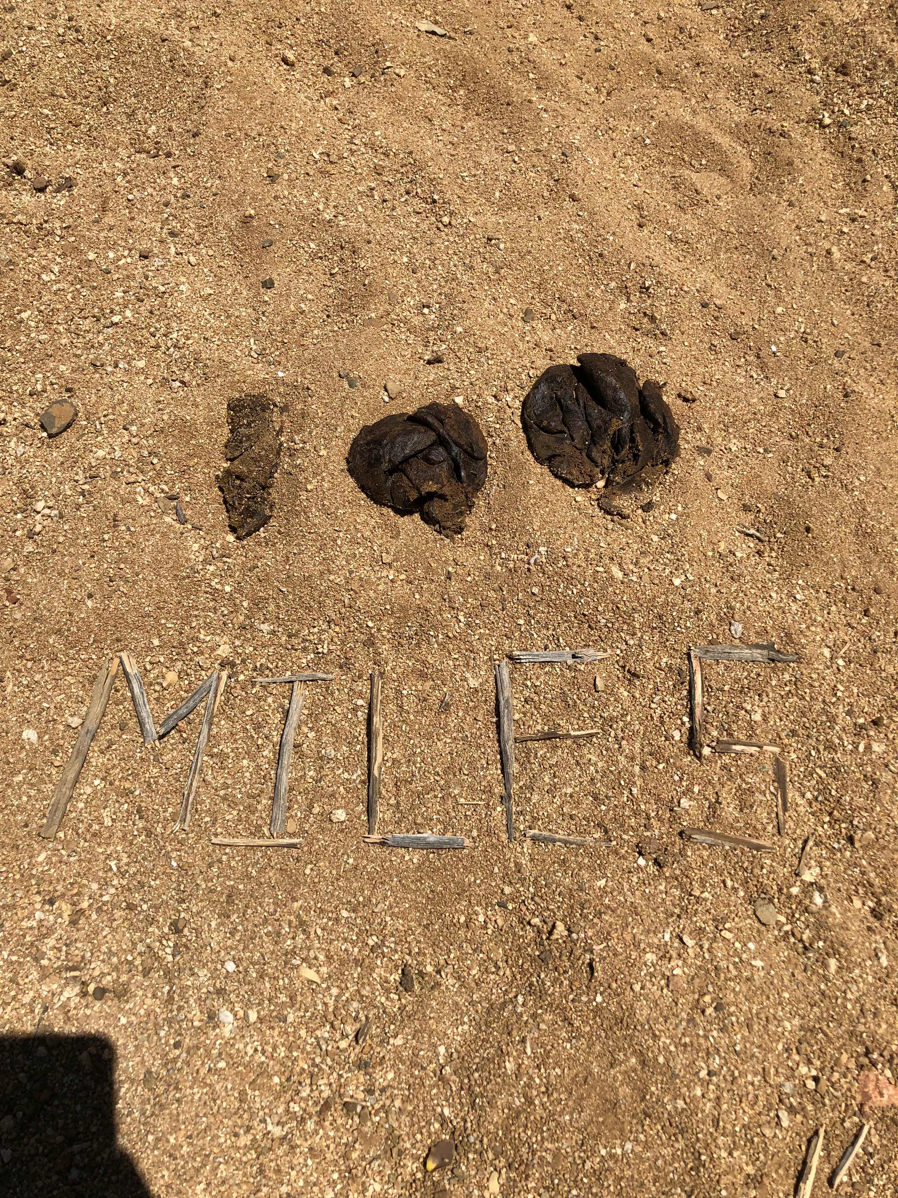
I hiked around a lot of cows today. This was the largest herd I’ve seen so far. There had to be hundreds. I left them alone and they left me alone. The only time they came too close to me was when I hit 100 miles. Nobody else had marked the trail yet, so I got to make my creation. The cows watched on in rising anticipation as I worked. I think this one is my all time favorite. 

Introducing a mile marker made of cow poop 💩 
I thought it was very fitting for the first 100 miles

Just after the 100 mile mark I hit my first water source of the day. It was surrounded by even more cows. As I approached the trough they all ran away. I found a nice suiting log and took a long break. I didn’t really need water yet, but it was only 1 o’clock and I’d already hit my first possible place to camp. There was no way I could stop so early in the day. As I was figuring out my next move, Scott(Turtle) hiked in. I haven’t seen him since we hiked together on day one. We talked for over an hour. We made plans to meet up at the next water source and I hiked on. I finally came up with a plan for where I was going to camp. Since it was only 5-7 miles away I decided to slow down and take lots of breaks. 

The hike to the next water went by quickly. The scenery was starting to change. It began to remind me of hiking in SoCal on the pct. It really had a high desert feel to it. Then I checked my elevation and saw that I was in fact in the high desert. I had climbed close to 2,000 feet since leaving Lordsburg. 
The next water source was a windmill well. The whole setup thrilled me. I have passed by quite a few of these in the trail, but this is the first I have used. I found the whole setup up curious and ingenious. What a great way to pull water out of a well 100 yards below ground. 

Co-op Windmill Well

Shortly after I got my water, Scott turned up. We talked for another long period of time before heading out. I noticed that we would climb another few thousand feet in elevation and I was eager to get started. I’m dry camping tonight and I wasn’t looking forward to carrying extra water uphill for a few hours. All of a sudden the scenery really changed and I stopped thinking about how much water weighs. I had crossed into the Gila River National Forest. For the first time in over 100 miles I began to hike on proper maintained trail. Oh, and there were trees. Real actual trees. I was in heaven. 

Shifting into the high desert

A coniferous tree 🌲 

Real trail and trees(Still not convinced that I died and went to heaven

With this abrupt change I am super stoked to start hiking in the Gila in a few days. I’ll even hike past the Gila cave dwellings. This trail is starting to get interesting. Tomorrow should be an awesome day. I made camp a little earlier than planned because I found a spot with great cell reception, a break from the wind, and a perfect sitting stump(really starting to feel like I died. This is too good to be true). Since the low is around 35 degrees tonight with a 14mph wind chill I decided to break out my tent. I haven’t set this thing up since my Utah road trip last spring. It feels weird to be confined to a tent. I really enjoy cowboy camping, but the tent should keep me a little warmer tonight. 

All of my Zpacks gear

The perfect sitting stump


"We keep moving forward, opening new doors, and doing new things, because we're curious and curiosity keeps leading us down new paths." - Walt Disney


Thursday, April 19, 2018

Day 5- Decision Upon Decision

Thursday April 19, 2018
Stealth Site(81.6) to Lordsburg(85.1) 3.5 Miles 

Daily up/down: +58.1 ft/ - 386.5 ft
Total up/down: +5,325.9ft/-5,484.3ft

The early parts of my thruhikes are when I enjoy town the most. My body is still adjusting to the rigorous task of hiking10 hours a day with a heavy pack. I need the time in town to help myself heal. I’m still always amazed by how quickly the time flies by. I have so little time to just sit and relax and today was no different. When I started on Sunday I thought I’d have to hike a full day today, but I set myself up nicely to get a nero. I made it into town just before eight o’clock. I was up and out of camp by 6:30 even though I didn’t sleep very well. I usually do a little bit of research on any potential animals that I might encounter while hiking. I know how to deal with, black bears, grizzlies, wolves, mountain lions, snakes, and tarantulas. What I failed to research was cows. Just before going to sleep last night I had a herd of 8 cows come within 20 feet of where I was camped. I had no idea what to do. I didn’t know if they would respect my territory or if they would trample me in my sleep. I had a few moments of hesitation before I got up and tried to get them to mosey along. They just stared at me, but eventually they moved on. 
In my everyday life I don’t don’t eat much junk food. I eat real non processed food. My stomach has been very upset since I started. I also attribute the heat and mild dehydration to the problem. Due to the cows and upset stomach I didn’t sleep well. Luckily it was a short hiking day. I had another beautiful sunrise, followed by an uneventful hike. I’m pretty sure this section of trail only exists so people can say they hiked from Mexico to Canada. I spent the last 85 miles hiking from cow water source to another cow water source. I’m not complaining, it just isn’t the most thrilling hiking I’ve ever done. I think a lot of the trail will be like this. I’ll get to hike in some of the most incredible places, followed by the most mundane. I guess that is all part of “Embracing the brutality”. 

Sunrise 

It is always nice to see town in the distance

I was very happy and surprised that the hotel let me check in immediately. That almost never happens. The EconoLodge in Lordsburg is definitely one of the most hiker friendly places I’ve ever stayed. Plus, it is only $48/night. I could afford to have my own room, which is a huge bonus. My plan was to drop my pack and go grab breakfast right away, but I took one look at the shower and changed my plan. It was so nice to get clean again. I totally haven’t adjusted to the hiker stink yet. I forgot how bad I can smell. Once I was squeaky clean I put on some semi-clean clothes and went in search of a good breakfast burrito. I didn’t have to travel far. There was a restaurant across the street with a great reputation. Kranberry’s really earned that reputation. The serving were large, cheap, and tasty. I had a giant breakfast burrito, hash browns, sausage, OJ, and coffee for $12. 

I always forget to take a picture before I start eating

After breakfast I went back to the hotel to begin plotting out my next leg of the journey. I have over 5,000 miles under my belt doing this, so you wouldn’t think it would take me too long. Well, the CDT is a completely different animal. If you’ve followed me on my other hikes, you will know that I’m a purist. I hike the trail the way it was meant to be hiked with no exceptions. The CDT is full of nothing but exceptions. I like to think of it as a choose your own adventure book. Almost everyday I am faced with alternate routes. I had expected to take only the major alternates. The alternates you can’t miss because they are better than the regular trail. Alternates like the Cirque of Towers in Wyoming. Or the Gila River alternate in New Mexico. What I’m starting to learn is that other alternate exists to prevent a 60 mile section with no water or hiking the old CDT because the new route isn’t finished and dead ends in the middle of nowhere. It makes the logistical side of things a nightmare. Whenever an alternate is involved the mileage stops adding up. I’m not sure if I’m hiking 64 miles until resupply or 111 miles. That is a huge difference. I’m still trying to not harp on my purist tendicies, much less make so many decisions. One of the reasons I like thruhiking is because I don’t have to make any big decisions. It is enough to drive one mad. I’m taking an alternate to my next resupply point in Silver City. It cuts about 20 miles off the trail, which really bugs me, but there are too many good reasons to take this route. It was the official route until 2 years ago. The CDTC changed the trail because of a new longer section they are planning. Only 20 miles are complete. This years official trail includes those 20(waterless) miles and then dumps you into a 14 mile road walk into town. The old CDT cuts out those 20 miles, but still includes a 12 mile road walk into town. Did I mention how much road walking this trail entails? I think over 20% of what I have hiked so far has been on roads, mostly dirt roads, but still roads. 

After I stop in Silver City I get to start the Gila River alternate. This one was a no brainer. The Gila is a highlight of the trip. I’ll see the Gila Cave dwellings and hike along the Gila River. I’ll finally be among trees and fresh water. I will cross the Gila River 85 times. I am beyond excited, but once again the planning was a nightmare. I had zero data on how long this section is. Usually I can look at my guidebook or guthooks and the info is one click away. This took me forever to figure out. I’m on official CDT trail out of Silver City for several miles. Then I hike an 105 mile alternate before going back up with the official trail. The best I can figure out is this section will be somewhere around 125-140 miles. New Mexico has a lot of long food carries. I’m planning on 7 days. I think I only did that once on the entire PCT and never on the AT. I had to put a lot of thought into what type of food to carry due to various water conditions and in consideration of weight. The first 4 days I’ll have a lot of water source(I think) the last 3 days water will be tight. I think I have second guessed every decision possible for this section. 

It’s amazing how quickly 1 small backpack can completely fill a room

I also had to make a lot of decisions for the leg after the Gila alternate because I need that food sent by May 1st and it can’t be my typical USPS priority mail. It has to be FedEx or UPS and I shudder to think how much that costs to expedite. Say what you want about the USPS, but their It Fits It Ships priority mail program is a hikers wet dream. I won’t get into the logistical nightmare of planning that section either.

I would be utterly lost without my executive team back home. Thanks General and Hannibal. I know it is a thankless task, but what you do helps keep alive and safe. 🍫🍪🥜🍬🍭🍝🍜🍩📦📫

Sorry if this post was confusing, hopefully it will make more since once I start hiking. Thanks for all the encouraging emails, texts, and posts. You all give me strength. May the force be with you all. 

"All you need is the plan, the road map, and the courage to press on to your destination." - Earl Nightingale